
There are two main types of sensors used in remote sensing technology, active sensors and passive sensors. Difference between these two is quite small, however, leaves great impact on their functionality. As we learnt in primary school, sun constantly emits light energy and is only source of natural light for earth. Moreover, this energy is not observed by any component in solar system. Instead it is reflected to somewhere else. Just like the moon, it shines despite of not possessing its own light source.

Passive Sensors:
Constituents of earth’s surface and its atmosphere produce natural emissions. Measuring these emissions is useful for global satellite purposes. For measuring these emissions, passive sensors are engineered using multiple microwave components and instruments. Passive sensors measure this energy or power as a function of surface combination of physical temperature, roughness and other physical characteristics related to earth. Fixed physical properties of substance being measured [earth in this case] are used to find measurement frequency bands for passive sensors. These fixed properties are also referred as molecular resonance. It is noticeable that frequency does never change and associate value cannot be duplicated with other frequencies present in the band.
Radio astronomy instruments are used to pattern the outputs acquired from passive sensors. These radio instruments are used for detecting and measuring very low power frequencies. These low frequencies are quite sensitive to accumulating radiation. Especially that comes from a radiation generating through a multitude of emitters located on the ground. In such criteria, both in band and out band frequencies are involved on which measurements are being made.

Active Sensors:
Active sensor is more of a radar instrument not a microwave one. Objective of this device or sensor is also for measuring signals. However, they do not come from the sun like this. They throw their own energy source towards earth. This energy reflects from the earth’s surface. These reflections are detected and measured by active sensors. Both earth’s physical surface and atmosphere reflects such energy exposed by active sensors. These space borne active sensor satellites are involved in a variety of remote sensing operations and observation of earth’s physical body and its atmosphere as well. For instance, rainfall rate over earth’s surface can be measured by observing radar echo over rainfall. Precipitation radars are capable of carrying out this operation.
Moreover, technology is evolved to the point of cloud monitoring radars. These cloud monitoring radars are capable of reflect echo over cloud and measure that reflection. Such reflection allows creating a three dimensional body of the cloud. It is useful in weather forecasting and disaster management. These active sensors operate in criteria of space research services or earth exploration satellite service. These satellites constantly share their data with other satellites to improve overall performance of various satellite services.
Difference Between Active and Passive Sensors:

Active Sensors |
Passive Sensors |
|
Active sensors do not measure or observe reflected sunlight rather they have their own source of light generated from illumination. Active sensors flash their light / illumination over the earth and measure the reflection coming from the earth surface.
|
Earth reflects the sunlight coming from the sun. Sensors capable of measuring such reflected sunlight are known as passive sensors |
|
Less used for satellite image. |
Passive sensors are more generally used because it deliver great quality satellite imagery. Passive sensor are superior in the field of technical observation of the earth, such as Multispectral and Hyperspectral technology. |
|
Active sensor and microwave energy have allowed satellite industry to capture image in day and night. Moreover, active sensor function regardless to weather or cloud conditions. |
Satellite dependent on passive sensors would become totally useless without existence of sun or sunlight. |
Applications of Active Remote Sensing:
(Also read Application of Remote Sensing)
The most important advantage of active remote sensing technology is they are capable of capturing and collecting surface information during day or night. Weather conditions does not stop that is if there is cloud senor will penetrate through it and capture the earth surface information. Following are some of the area where active remote sensing is dominant.
 Vegetation: Radar signals interacts with the vegetation in a very complex ways and penetration level of signal depends on it’s strength and water content of the vegetation. Return radar signal may include of trunks, stems and leaves aswell ground surface. This type detail information about the vegetation can only be captured using this type of sensor, SAR data are used all over the world nowadays for vegetation studies.
 Water Bodies: Fresh water is important for human civilization and maintaining it is very important. Hydrologist seeks to understand the movement, distribution and quality of water on Earth. Active remote sensing like airborne or spaceborne can be used to measure the water in its various forms.
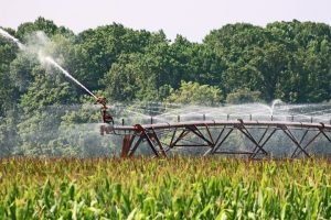
 Soil Moisture: Radar technology is used to measure the soil moisture. Measurement of soil moisture can be important in different fields: hydrology, agriculture, climate monitoring, weather forecasting and disaster mitigation.
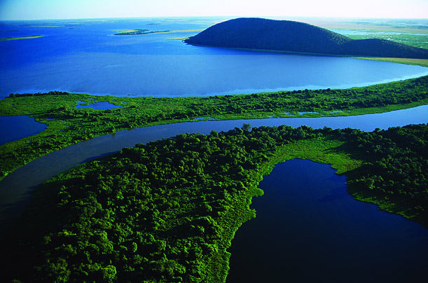
Surface Water: Understanding the temporal and spatial variations of water in rivers, lakes and wetlands is very important for the life of earth plant.Radar  technology is highly accurate for identifying the area of the surface water and the water levels accuracy range in centimeters using the interferometric technology.
 Groundwater: Balance of groundwater and surface water is necessary for increasing demand for drinking water or for irrigation. Active remote sensing can be effect to penetrate the soil to measure the acuqufiers (<100M) and this is possible when surface soil is dry.
 Snow: Measurements of snow-pack extent and snow water equivalent (SWE) are very critical for balancing water supply in many areas and also forecasting the river water flow, avalanche and other snow related disaster. Radar technology can be used to perform snow related analysis.
Sea Ice: Due to peculiar back-scatter value compared  to water, active remote sensing is used to find out sea ice extent and age.
-
Other Active Remote Sensing Applications:
-
Ice Sheets and Glaciers
-
Topographic Mapping
-
Urban Planning and Disaster Management
Types of Active Remote Sensing:
Based on the range of the electromagnetic spectrum, there are three types of active remote sensing.
Active Optical Remote Sensing: On Active optical remote sensing laser beam or light is used to hit the target which will illuminate it and then reflected or back-scattered radiation will be analyzed. The most popular active optical remote sensing will be LIDAR technology.
Also Read: LIDAR Data 50 Applications and Uses- It is important
Active Thermal Remote Sensing: It deals with the information recorded in the thermal infrared range. Still this field need more development and passive sensors are used to acquired information on this range. LIDAR can be used to acquire information in the thermal infrared range.
Active Microwave Remote Sensing: It operates in the microwave region and RADAR is the example of it. On this type, sensor emits microwave (radio) signal to the specific target.
Few terms used in Active Sensors:
Majority of active sensors operate in the microwave portion on the electromagnetic spectrum. This makes it possible to penetrate atmosphere in any circumstances.
Laser Altimeter: The instrument that is used to measure the height of the platform ( aircraft) from the surface.
LIDAR: A light Detection and Ranging which uses laser beam to hit the target and receive the backscattered or reflected light.
RADAR: RADAR is a type of active remote sensing which generates it’s own electromagnetic wave that transmits in the form of radio signal to measure range angle or velocity of the objects.
Ranging Instrument: A device that is used to measure the distance between the target object and the instrument.
Scatterometer: A high-frequency microwave radar which is used to measure the backscattered light or radiation.
Sounder: A instrument that is used to measure the vertical distribution of precipitation and temperature, humidity.
Pros:
Since natural light is not required them for functioning, they are capable of capturing satellite imagery regardless to time, let it be day or night. Cloud and weather conditions do not affect the imagery quality at all. For dealing with clouds, microwave technology is used in these active sensors.
Cons:
In most of the active sensor satellites, radars are quire noisy and sometimes overbearing too. For an inexperienced user, satellite imagery is quite similar to a bunch of USELESS images full of scattered pixels. The pictures aren’t pretty at all. However, it does not matter since such satellites are commonly used for flood observations which do not require image quality much.
Some of the most common examples of Active sensor satellites are RADARSAT-1 and RADARSAT-2 by Canadian space agency [CSA], Airbus defense and space Terra-SAR-X RADAR Satellite and LIDAR [Light Detection and Ranging].
Applications of Passive Remote Sensing:
LANDSAT mission is the longest running mission till the date, earth is observed with the help of it. Tons of information and documentation about changing earth is collected thanks to LANDSAT mission. This mission has been running since 40 years now. Knowing this, one can understand that remote sensing must be throwing some benefits for entire globe. And definitely, that is true. Following is a list of most common applications of passive remote sensing technology:
Also Read: 120 Landsat Data Applications, Used in Different Field
Satellite data is constantly being integrated in many modern technical fields and industries such as oil, gas, land management, energy, defense and military, agriculture, coastal applications, etc. This is just a glance. To get in more detail, there are hundreds and thousands of applications of satellite remote sensing technologies covering most of the modern technical fields.
- Agriculture
- Biodiversity
- Changes in climate
- Disasters
- Observations of ecosystems
- Forest
- Energy
- Fire
- Health of humans
- Land use control
- Growth of urban areas
- Water observations, etc
Few passive remote sensing satellite example are: Digital Globe and Astrium/ Black Bridge,Geo Eye, World view, Quick bird , SPOT, Pleiades satellites and many more.
How Reflected Sunlight is Detected by Passive Sensors:
Electromagnetic radiation is constantly generated by sun and is exposed into the solar system. This process will remain constant as long as sun exit. Since earth is also a part of solar system, this radiation strikes here too. This electromagnetic radiation is also sometimes referred as incident energy. Incident energy interacts in three different ways with earth surface . These three different interactions are as follows:
-
Reflection
-
Absorption
-
Transmission


These energies are respectively denoted as Er, Ea and Et. It ultimately means that total incident energy is summation of these three various interactions. If incident energy is denoted as Ei, then Ei = Er + Ea + Et.
Specific wavelength or certain frequencies are used by passive sensors for measuring this reflecting natural energy. Not all of this energy is reflected in the same form. That is why passive sensors are designed or engineered in a way so that they can measure it in different forms. For instance, they can track visible energy [390-700 nm], infrared energy [750-1 nm], ultraviolet energy [100-400 nm] and even more types of such EM radiation. Various forms of reflected incident energies with different wavelength ranges are also referred as bands. Sensors possess multispectral imaging technologies that are multiple bands; about 3 to 10 each. These bands can also be in hundreds of number. Such huge collection is also referred as hyperspectral imaging technology.

Reflected light and Spectral Reflectance relationship:
Different features energy’s reflection, absorption and transmission is on different proportion. Light rays are in form of incident energy as described above. It turns into reflected energy as it bounces back from the earth surface to passive sensors. Sensors are engineered to detect such reflected energy. If absorbed and transmitted energy amount is deducted from total incident energy, the rest is referred as reflected energy. Which means: Er = Ei – Ea – Et.
Also read: Vegetation Spectral Signature Cheat Sheet
Moreover, every single object on the earth acts different with this energy. Different amount and proportions of such energy is transmitted, absorbed and reflected by these objects. Each object has their unique spectral reflectance. Spectral reflectance of any object is simply the amount of incident it reflects back to satellite. Spectral reflectance is denoted as p. Following formula is used for determining spectral reflectance:
P = Er / Ei
This study clearly indicates that passive energy would be of no use if there is no sun and that means no more natural energy would be there to absorb.
READ NOW: Know Basics of Remote Sensing Quickly and Become Expert

FARRELL MAGUN
25 Nov 2019HELP ME WITH MORE OF GIS NOTES AND INFORMATION