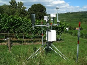
Remote sensing is a science that uses the electromagnetic spectrum to observe and collect data on an object. In remote sensing, there is no physical contact with the object under study. It refers to all photographs and videos taken from above at a significant altitude. Remote sensing photographs capture a large area of the Earth’s surface than a person on the ground can capture. In this case, the images are mostly used in helping to determine the health of forests, study the changes in geographical features and military applications. When dealing with remote sensing, the concepts you need to consider include the following;
- Radiometric resolution- refers to the sensor’s ability to capture the contrast of an object.
- Spectral resolution- the sensitivity to a frequency-range feature of the sensor.
- Temporal resolution- depends on factors like the swath of the sensor related to its footprint.
- Spatial resolution- the ability of a sensor to distinguish two objects over the smallest possible distance.
On the other hand, photogrammetry is the study of stereo pair aerial photographs using imaging rather than collecting light wavelength data. It is a 3D coordinate measuring technique that uses photographs as the fundamental medium for measurement. Photogrammetry is broken down into two main branches: interpretive and metric.
- Metric photogrammetry is a branch that deals with precise measurements and computations on photographs regarding the shape, size, relative locations, position of photographic features, and many other quantitative details. Photographs are shot using a metric camera and are mostly used in industries like surveying and engineering.
- Interpretive photogrammetry- it is a field that involves identifying general photographic physical features like size, shape, shadows, and patterns, which add quality and profession to the information in the photograph.
Similarities
1. Imaging systems
Remote sensing and photogrammetry both work with images to gather information about a particular object or area on the Earth’s surface despite the differences in formats and platforms used to get the photographs.
There are other similarities of photogrammetry and remote sensing based on the image resolutions and their applications.
2. Environmental impact assessment
Environmental science often uses remote sensing to gain reliable and concrete data on ecological change processes. Such assessments are made easier with the use of photogrammetry and remote sensing, especially when it comes to mapping and images of the area under study.
3. Emergency management
Both remote sensing and photogrammetry have been used and applied in emergency management. In an emergency, the professional always need reliable data to develop plans to contain occurring disasters. An example of such is forest fires. Remote sensing can provide an accurate topography picture and a map that scales the disaster area. On the other hand, photogrammetry will enable teams to generate reliable three-dimensional models for planning containment approaches and evacuation routes.
4. Architectural recordings
When conducting architectural recordings, remote sensing and photogrammetry allow the specialists to survey historical buildings without touching or damaging architectural features. Images from remote measurements help ensure that the structures’ integrity continues. Images from photogrammetry allow the involved teams to develop 3D maps.
5. Forensics analysis
It is important not to tamper with the scene or any evidence left behind at any crime scene. Despite this, examinations of the crime scenes by law enforcers may lead to evidence destruction. Photogrammetry offers an ideal solution whereby crime detectives can use drones to fly ahead and take photographs of the scene. While also keeping track of the crime scene using videos and images from remote sensing satellites.
6. Monitoring of mining activities and expansion possibilities
Mining companies always need reliable methods of monitoring their existing mines and looking for ways to expand safely. Such data is important, and therefore, both photogrammetry and remote sensing can help such companies develop maps and 3D images for these purposes.
7. Earthwork development
Any building and development activities’ success will rely on accurate data. For any earthwork development activities to thrive, there has to be detailed information about the topography and landscape of that particular geographical area. Engineers use remote sensing and photogrammetry data and images to collect data for grading the land and planning construction activities.
8. Data source
In both techniques, imagery (related to images) is used to collect information. The techniques can record and take images of features without coming in contact with them. Additionally, these images are used as the primary source of data in many institutions and research centers.
9. Airborne components
Remote sensors and photogrammetry components can be confusing to a new user, both are remotely located, and therefore, they are found in the space or sky above the ground. This feature makes the components look alike though other minor features can differentiate them.
10. Remote measurements
When estimating the size of any physical feature, a method is chosen that can give a close or exact result. Remote sensors and photogrammetry components are vital measurement equipment that is used to measure different heights and lengths.
Additionally, the images taken by these two techniques cover a much wider area and thus can be used to estimate the distance from one physical feature to another.
11. Source of power
Different types of equipment rely on different sources of power to operate. However, the techniques are dependent on either solar or charged batteries as the main source of energy. This is because they are airborne and mobile.
12. Spatial Resolution
Most of the techniques involving the Earth’s features are designed so that even the smallest features can be distinguishable from other features. Both Remote sensors and photogrammetry components ensure this is achieved. Both can identify the smallest detail of pattern on an image which is vital during the research analysis.
13. Images quality
Both techniques output images with low quality (not clear). This is because they are taken from the sky, and the quality of the image may be affected by environmental factors like fogs, etc.