
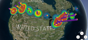
Geographic Information Systems (GIS) are becoming critical components of the pipeline routing process. For the oil and gas industry, GIS is used to store, analyze, and manage geographic data pertaining to an oil and gas project. By creating a complete GIS rendering and simulation of a geographic location, an oil and gas company can provide better, more accurate estimates regarding their current and future projects.
Here’s how GIS is revolutionizing pipeline routing, and how drone technology is being used to improve upon it.
The Importance of GIS for Pipeline Planning and Development
Oil and gas companies have a lot to consider when they plan new pipeline. Decades ago, most pipelines could be laid in a straight point-A to point-B course; there was very little standing in the way. Today, environmental concerns, preexisting infrastructure, and even other pipelines make it difficult to find a clear path. This has created a need for new technologies and new processes.
GIS can be used to easily identify potential roadblocks to pipeline planning, making it easier for pipeline developers to find a clear course that’s still as cost-effective and efficient as possible. Rather than having to potentially change course later in the project (which can be extremely costly), the developer will know exactly where the pipeline is going to be laid from the start.
GIS is used to:
- Identify the most effective routing for pipes. Pipes need to be routed as directly as possible, while still not intruding upon existing structures. Today, there has been such a significant amount of pipeline laid down that it can be difficult to avoid other pipelines — not to mention the potentially large amounts of development that may be present in any given area.
- Plan around obvious obstructions. Pipelines don’t necessarily need to go around obstructions, but can instead attempt to go above, below, or through them. Nevertheless, planners need to be aware that an obstruction exists so they can account for it. GIS data can be used to identify these obvious obstructions, while also maintaining right-of-way.
- Locate any potential environmental concerns. Environmental regulations have gotten stricter, with environmental impact studies necessary for every major development. An environmental impact survey requires in-depth information about the surrounding area, which will need to be analyzed to determine whether there are any major causes for concern.
- Simulate how the new pipeline could impact the surrounding community. In addition to determining whether there could be environmental impact, the pipeline project also needs to explore how the surrounding community may be impacted by the new development. This includes studies regarding potential disruption or runoff, as well as concerns as to how a leak or malfunction could affect the surrounding area.
- Improve the project’s bottom line. There are multiple ways in which GIS can reduce a project’s costs, like reducing the chances of an accident, increasing adherence to regulations, and meeting environmental impact studies. As the project continues, GIS and surveying can be used to ensure that the project is moving forward correctly.
Ultimately, pipeline routing with GIS is safer, cheaper, and faster than traditional methods. When pipeline routing is done without GIS, a significant amount of data must be compiled manually, and the entirety of the project may potentially be disrupted. Of course, that still leaves companies with a question: What is the most effective way of gathering GIS?
Collecting GIS Data Via Aerial Surveying
Aerial surveying makes it easy to collect accurate GIS data quickly. With the power of aerial surveying, GIS information can be collected in as little as an evening. This level of speed is incredibly important: Surveying must be done before the pipeline can be routed, and delays in pipeline development will likely be extremely costly.
Faster and safer than traditional ground surveys, aerial surveys collect large volumes of 3D topological information from above. When these aerial surveys are completed by drone, they have higher resolution and greater accuracy; drones can fly low to the ground, getting more 3D information, and thus making the project less likely to experience issues in the future.
Aerial surveys conducted via drone can be almost immediately deployed, depending on the weather, and multiple drones can be used to collect information from larger swathes of territory at once. Drones are more cost-effective than plane or helicopter surveys, because they don’t require a manned crew or specific licensing and permits. Drones are also faster than ground surveys.
A combination of GIS and aerial surveys will be able to provide improved visibility across any potential project site, saving a company money and improving upon the project’s ultimate outcomes.
Using GIS Data for Simulations, 3D Modeling, and Future Development
Once GIS data has been collected with aerial surveys, it can then be used in advanced simulations and 3D modeling suites. Not only can this GIS data be used to route pipelines more effectively, but it can also be used to simulate potential environmental issues, disasters, and other scenarios. GIS data can be used to create comprehensive environmental impact reports and advanced 3D presentations. All this information can be presented to everyone from investors to environmental surveyors.
Furthermore, aerial surveys and GIS data can be used for future additions to the development, as well as management and maintenance of the work site. During the pipeline development process, GIS data and aerial surveys can be used to make sure that the project is progressing as it was planned, and that there aren’t any unexpected complications. Once the project has been completed, regular aerial surveys can be used to identify damage to the pipeline or spot maintenance issues before they become severe.
The oil and gas industry is increasingly leveraging advanced technologies for better results. GIS (and UAV technology) can reduce the costs of pipeline projects as well as the potential risks. By making the project faster, safer, and more effective, GIS can also make it more profitable, protecting the oil and gas company’s bottom line, both during construction and after the project has been completed.
 Guest Post: Dustin Price is a licensed land surveyor and the Operations Manager at Landpoint. He leads the company’s technical approach to delivering professional surveying services by providing tailored solutions using UAV technology.


Geomembrane leak location surveys
5 Apr 2019This is some really good information about the GIS. It can actually be very helpful if the regarding person knows how to perform the process. Thank you very much for explaining everything so nicely step by step. You are doing a great work by sharing this information here.
Geomembrane leak location surveys