LIDAR stand for Light Detection and Ranging which is a Remote Sensing technology used to measure the features of the earth surface, create DEM (Digital Elevation Model). LIDAR use laser beams to hit the target and record back the reflected energy. It is the active sensor which generates numbers of pulses. This reflected pulses gives detail information of the objects. For example Laser pulse will hit the top, middle and bottom part of the tree to generate tree model. A LIDAR instrument consists of a laser, a scanner, and a specialized GPS receiver. Helicopter or plane are the most common platform for this instrument.
Global Mapper LIDAR Module R16
Global Mapper is the easy to afford GIS software which suit both new and advance user. This software has all the major tools, extension that is required to do the GIS analysis. It is very easy to use.
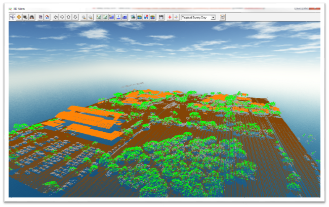
LIDAR Module: This is a optional purchase module for the Global Mapper. This add advance LIDAR function to the software. Some of the advance LIDAR features are automatic point cloud classification, feature extraction, cross-sectional viewing and editing, dramatically faster surface generation, and many more. For detail about the module read on their official website.
http://www.bluemarblegeo.com/products/global-mapper-lidar.php
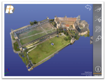
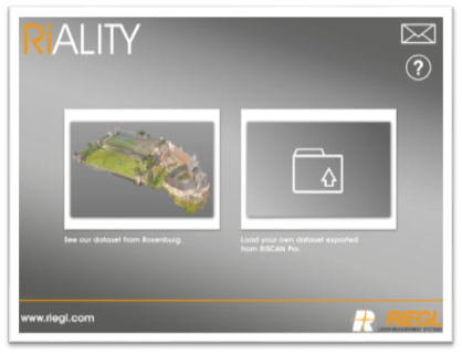
RIALity Apps
It allows user to visualize points cloud acquired through RIEGL laser scanners. It is an IPad application which requires iOS 5.0 or later. It shows true 3D color of the point cloud. Some of the features of this application are as follows:
More detail go to: http://www.riegl.com/media-events/multimedia/3d-app/
- Point Cloud Viewer: Visualize 3D Point Clouds on IPAD.
- Touch Navigation: Touch screen to navigate.
- Augmented Reality: Print a reference image and experience point clouds in Augmented Reality.
- Single color and True color mode for point clouds.
- Adjust point size.
- Orthographic and Perspective visualization mode.
3. Lizardtech – LIDAR Compression Tool
LIDAR Compressor
This company has number of interesting tools for the GIS system. One of the popular tool for the LIDAR data is LiDAR Compressor. It compress the LIDAR data which reduce 25 percentage of the total size while retain the every return. It compress the data in MrSID format. It is very easy to handle too.
More detail go to: http://www.lizardtech.com/products/lidar/
4. LIDAR in Arcgis
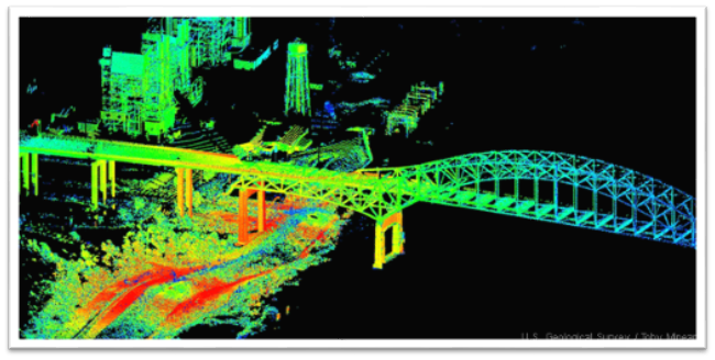
LIDAR in Arcgis
Arcgis is a leader in GIS software and it has advance LIDAR tools for the point clouds. Tools help to do advance GIS analysis, make decision and use for scientific research. ESRI magazine has a interesting topic about working with LIDAR, http://www.esri.com/esri-news/arcuser/summer-2013/5-ways-to-use-lidar-more-efficiently. You can train yourself about using LIDAR image in Arcgis, it is a free course http://training.esri.com/gateway/index.cfm?fa=catalog.webCourseDetail&courseID=2497
Other resources:
Using LIDAR in Arcgis 10.1: http://resources.arcgis.com/en/help/main/10.1/index.html#//015w0000003z000000
A quick tour about LIDAR:
http://resources.arcgis.com/en/help/main/10.1/index.html#//015w00000066000000
LIDAR and 3D: http://www.esri.com/industries/map-chart-dataproduction/lidar
5. LP360
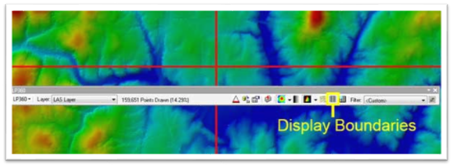
LP360 Extension
IT is an extension to the ArcMap which turns it LIDAR processing capability to great extent. It can be used in very large dataset. LP360 is available in three capability. It has tools from rapid visualization and derived product generation. Also in advanced features, it provides automatic ground classification and building footprint extraction.
More detail go to: http://www.safe.com/solutions/for-data-types/lidar-point-clouds/
6. FME
FME known as Feature Manipulation Engine which has hundreds of tools for data transformation. Some of the tools are used for the LIDAR point cloud data. You can transfer LIDAR data into other formats quickly and easily. Find more information about LIDAR and SAFE products: http://www.safe.com/solutions/for-data-types/lidar-point-clouds/
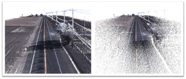
Before and after FME is used to thin a LiDAR dataset of a section of highway.
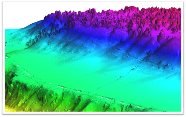
GRASS GIS – LIDAR Tools
Grass is most popular open source GIS software which has LIDAR tools for processing of point cloud and use the output product for the GIS analysis. It,s tools supports basic and advanced LIDAR data processing and analysis. More detail help files are at GIS wiki http://grasswiki.osgeo.org/wiki/LIDAR
8. ENVI – LIDAR

ENVI LIDAR
ENVI stands for Environment for Visualizing Images is one the most popular software for remote sensing. It is used by most the remote sensing expert but not for the GIS. ENVI LiDAR lets you create 3D visualizations and easily extract important features and products from raw LiDAR point cloud data. Then you can exported data into other your handy GIS software. Find more information at http://www.exelisvis.com/ProductsServices/ENVIProducts/ENVILiDAR.aspx

Bentley Points tools is a stand online software that has a capability to process point cloud data. It creates for point clouds quickly for distribution and reuse. Find more information at http://www.bentley.com/en-US/Promo/Pointools/pointools.htm?skid=CT_PRT_POINTOOLS_B
10. AutoCAD MAP 3D – LIDAR features
AutoCAD Map 3D 2015 has features included which can work with LIDAR data. You can create DEM form LIDAR data. It uses indexing method on the point cloud data which make easy to load and perform analysis on it. More about AutoCAD Map 3D features read on their blog http://knowledge.autodesk.com/support/autocad-map-3d/learn-explore/caas/CloudHelp/cloudhelp/2015/ENU/MAP3D-Use/files/GUID-7C7DD8A7-B561-45B0-A803-852E0A667F3C-htm.html
Oher info at: http://www.autodesk.com/products/autocad-map-3d/features/all/gallery-view



LAStools
19 Jul 2015Based on its incredible number of fans and users it is surprising not to see LAStools taking the top spot in this list. And RiALITY? Who has ever used that? I thinks that RiALITY may be the least used LiDAR tool ever … (-:
admin
19 Jul 2015Thank you LAStools, appreciate for your comment. Please check my email.
Tiana Warner, Safe Software
6 Aug 2015Thanks for the FME shout-out. Coincidentally, we have a webinar coming up this Wednesday with tips for working with LiDAR using the ArcGIS Data Interoperability extension: http://fme.ly/qps
admin
6 Aug 2015Thank you
Leo
29 Dec 2016Should really check out Lidar360 and the company’s LiForest and LiMapper (http://greenvalleyintl.com/product/lidar360/).
joe
20 Sep 2017Umm was thinking this was good info until I realized Terra solid is not included. not sure why, if you search all the job listings looking for a LiDAR Analyst most state Terra Solid experience necessary.
admin
27 Sep 2017Will add it after reviewing it.
Eddison
27 May 2018Hello, does anyone have the LASTaskTools viewer? Thanks, Eddison
Dee Wu
27 Jul 2018It seemed pretty limited to me. I suppose it depends on your applications, but Terrasolid and LiDAR360 seemed pretty comprehensive. The latter being quite a bit cheaper.