Remote sensing is the application of unique cameras to detect and evaluate the characteristics of a given area by measuring the emitted radiation. In drought management, cameras on satellites and airplanes are used to take images of large areas of the environment. The images are highly magnified, allowing researchers to see much more than they could see when physically investigating the surface. Remote sensing technology in drought management is used to monitor the drought patterns of a given area. Below are some of the applications of remote sensing in drought management.
1. Satellite-based Soil Moisture and Evapotranspiration Estimation
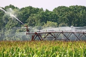
Soil moisture is a crucial parameter for early warning of agricultural drought—soil moisture partitions energy at the ground surface into the atmosphere through evapotranspiration. Remote sensing in soil moisture estimation collects data over large areas and makes comprehensive measurements near the soil surface possible. The sensors can sense moisture in the surface layer up to two to five cm below the ground.
2. Remote Sensing-based Precipitation Estimation and Evaluation
A standardized precipitation index is a valuable tool used to estimate the intensity and duration of a drought event. The tool quantifies the degree of wetness and dryness by comparing the actual rainfall with the historic rainfall over different periods. SPI can be accumulated for different periods, i.e., short-term, medium-term, and long-term patterns.
3. Data Mining and GIS Applications to Drought Monitoring and Prediction
Several groups of people, including policymakers, consultants, relief agencies, farmers, suppliers, and customers, are interested in accurate and reliable information about the nature and prediction of drought. Remote sensing techniques have come in handy to make it possible to obtain accurate information. Developments in computer technology and the Geographical Information System (GIS) help process observations from the sensors for potential identification and assessment.
4. Building Drought Early Warning Systems (DEWs)
Drought Early Warning Systems are based on observations from drought-related parameters such as rainfall, weather, temperature, surface wetness, water availability, and crop condition in most countries. Satellites are used necessarily to cover a wider area and provide accurate results. These systems improve the government’s capacity to monitor, forecast, plan for, and develop a strategy for coping with the impact of the drought event.
5. Use of Remote Sensing Data for Food Security
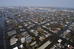
Drought is the single most dangerous weather-related disaster that can affect areas for months or even years. The disaster has a significant impact on food production and affects the life expectancy of the entire population in the affected areas due to starvation. Drought also leads to substantial economic losses and destruction of ecological resources in the environment. Research has it that drought has affected over 35% of 3.5 million people who lost their lives.
6. Vegetation Monitoring

Vegetation monitoring entails examining the overall effects of rainfall, soil moisture, weather, and agricultural practices on vegetation present in the ground. The satellite-based monitoring of vegetation plays a vital role in drought monitoring and early warning after determining the rate of vegetation development in a particular area.
7. Rainfall Monitoring
Rain is one leading cause of drought events. Remote-based and satellite-based methods used for rainfall estimation can be grouped into three:
- The visible and infrared techniques (VIS and IR)
- Passive microwave technique
- Active microwave technique
The above methods use sensors to estimate rainfall through clouds identified in the satellite imagery, precipitation particles, and rain rate levels.
8. Risk Zone Identification
Long before a drought event occurs, the risk zone is usually identified to help come up with predictions concerning the intensity of the drought. Predictions are made with the present historical data of rainfall and evaporation. The remote sensing-based method identifies prone areas using the trend of vegetation growth, frequency of low development, and standard deviation.
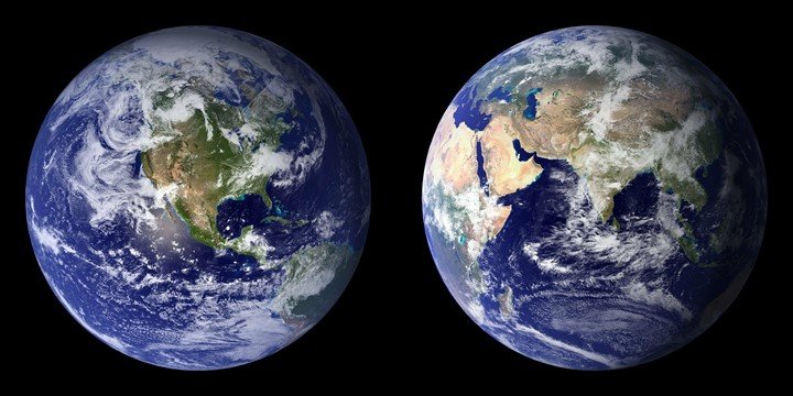
9. Earth Observations that Include Satellite, Climate, Oceanic and Biophysical data for efficient Drought Analysis
Since drought is a devastating natural hazard, remote sensing and GIS technology monitor the environment by frequent observations on the climate, ocean waves, soil, and water for efficient drought analysis. A satellite can explore a given area in a few days at regular intervals to provide room for identification, monitoring, and drought assessment. The information derived from these techniques is essential for drought warnings.
10. Seasonal Prediction
Centers such as the National Climate Research Centre of the United States, the European Centre for Medium-Range Weather Forecasts, the India Meteorological Department, and many more make seasonal predictions on temperature and precipitation. These centers use geostationary weather satellites for quality seasonal climate predictions.
11. Climate Change Monitoring
The remote sensors used in drought prediction can be used to make climate variability predictions using factors such as:
- Atmospheric models
- Survey of snowpacks
- Circulation patterns in the ocean
- Soil moisture
- Water available for irrigation
Such data is evaluated to allow for drought warnings in advance; early warnings give nations time to create policies concerning agriculture, fisheries, and distribution of goods.
12. Surface Temperature Estimation
The satellite-based surface temperature estimation is among the indicators of drought monitoring; it entails balancing the energy between soil and plants. A low rate of evapotranspiration from plants is a sign of drought. Local communities should be warned about an upcoming drought event when the surface temperature is not as required. Early warning helps decrease the risks associated with crop loss, food loss, and death of people.
13. Ground Water Fluxes
Groundwater can have a critical role in sustaining the functioning of ecosystems like plants. Plants entirely depend on groundwater for their growth and development; therefore, they can quickly dry up during a drought event. Remote sensors use factors such as humidity, wind speed, radiation, rainfall, and air temperatures to monitor the degree of groundwater fluxes.
14. Assessment of Drought Impact
Remote sensing use for drought impact assessment entails investigating factors such as; land use, infrastructure, demographics around the affected area, intensity, agricultural yield, water availability, pests, and diseases. After the assessment, high-resolution satellite sensors are used to study the affected area for relief support. Remote sensing use for relief management involves water management, crop management, and mitigation strategies.
15. Snow Monitoring
Snow is a natural reservoir of natural resources. A deficit in the snowpack of a given place could lead to agricultural or hydrological drought. This, in turn, will reduce soil moisture, which can impact water storage, fisheries, vegetation, and irrigation. Therefore, monitoring snow using remote sensors is fundamental to drought assessment in various regions. Snow forecasts help people respond appropriately to changes in water temperatures and moisture conditions.
Drought is a complex and recurring natural disaster that can occur anywhere globally. It can cause so many negative impacts on the different sectors of society, i.e., decreased growth in the economy and increased deaths due to lack of food. Drought monitoring can sometimes be challenging, especially if the traditional drought monitoring approaches are used. Tools such as satellite-based remote sensors were introduced recently to help researchers estimate several critical variables related to drought.