Natural disasters are common occurrences that result from natural causes like floods, volcanoes, earthquakes, etc. Disaster management is a general term used to stand for processes involved in strategic planning and procedures administered in controlling occurrences of natural disasters. Remote sensing techniques can be effective in reducing the risks of disasters and helps in the identification of hazards zone and causes. Thus, this technology plays magic in the prevention and management of natural disasters.
Applications
Remote sensing technology has become an important tool in environmental management. In disaster management, remote sensing has various applications:
1. Tracking wind patterns
The wind is one of the causes of disaster in the environment. Hurricane disasters can be sensed and be predicted by the use of remote sensors. These sensors pass the early warning to people living in the affected area, and they can relocate to avoid damages.
2. Detecting earthquake

Remote sensors can detect the onset of an earthquake. Thus they provide useful information that can be used to predict areas to be affected. This promotes relocation of the vulnerable groups hence saving life and valuable things.
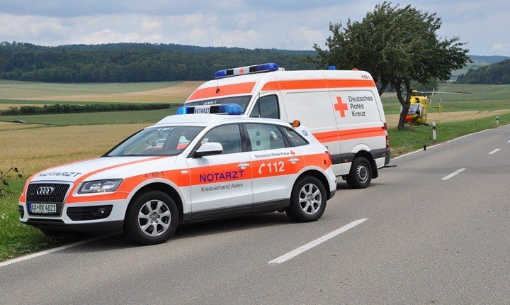
3. Relief operations
After any natural disaster, many areas are inaccessible, which poses a great challenge in assessing and managing the damage. However, the remote sensing technique got the operation covered. It assists in disaster assessment and monitoring as it is sky-based, thus providing important information in relief monitoring operations.
3. Wildfires
Forest fire is a type of disaster that may result in a great loss if not controlled. Thus proper protection needs to be laid down to avoid fire attacks. Remote sensors are used as a warning tool for early warning systems and provide information on the areas affected by the fire. The early warning enables people to have suitable plans to extinguish the fire and thus hindering its spread.
4. Floods management
During rainy seasons, many places get flooded, and immediate action is needed to rescue the vulnerable group. On-site observation of the affected area may be possible as all the land has water, and therefore an alternative method is required. The remote Sensing technique fits best in such a situation; since it is sky-based, it may take an image on the earth and hence initiate rescue missions.
5. Drought prediction

The rise in the earth’s temperature may result in drought and other high temperature-related defects. However, sensors may be used to predict the temperature rise. Since they are sky-based, they are able to measure the temperature of the reflected radiation from the earth’s surface; the information obtained may be compared with the previous ones. In case of an increase in temperature, a warning is passed to the vulnerable group, and relevant activities are taken to reverse the temperature rise.
6. Identification of hazards zones
Not all areas are likely to experience natural defects, while others experience natural disasters more frequently than other zones. Therefore, in identifying areas that are vulnerable to natural disasters, the remote sensing technique is widely used. It provides information such as intervals between one occurrence of the disaster and the other, the type of disaster commonly affecting the area, and the vulnerable areas. The information provided by the sensors is of great importance as it is used to relocate people during disaster periods.
7. Reconstruction of areas affected
Many areas are affected during or after natural calamities, and there’s a need to reconstruct them. However, on-site locating these areas may pose a great challenge as only a limited area is covered. Remote sensing technique helps in easing the process has it able to cover a wider area at the same time.
8. Disaster management study
In the study on how to control and manage natural calamities, various methods are implemented. Remote sensing is one of the powerful tools in this study. It provides researchers with the required information and data concerning the environment used in their decision-making.
9. Glacial lakes assessment
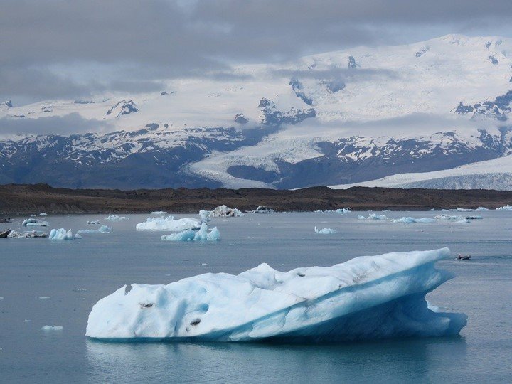
Glacial lakes, found on top of mountains, may be a good tourist attraction and a threat to the nearby areas. Since they are found on the top of the mountain, it is impossible to assess them from the ground easily; a view from above is required to assess them. Thankfully to remote sensors as most of them are sky-based. They assess the glacial lakes and predict any dangers related to these lakes, thus enabling the people living nearby to relocate early in case of any danger.
10. Emergency mapping
Remote sensing technique has a vital role in emergency mapping to promote an easy and quick disaster response. The sensors provide large, widely, and timely data used by the emergency team to plan how they will carry out the rescue mission.
11. Risk mapping and management
In many cases, human activities contribute to initiating natural disasters. However, to control this, the remote sensor may be used to map human risks that are likely to bring a calamity. Risk mapping provides a report and information that can be used to warn people on their disaster-causing activities and be used to prepare and prevent the disaster.
12. Data analysis
Data analysis is essential in all fields. In the disaster management field, data analysis is necessary as it can be used to predict the future occurrence and extent of any given calamity that occurs naturally. However, obtaining these data and information relies on the various data collection methods; remote sensing technique is the best and primary source of disaster assessment. Unlike other methods, remotes sensors can record the extent and strength of the calamity, making data comparison simpler.
13. Resource allocation
The government also relies greatly on this technique to fund and support people affected by the disaster. Here, sensors are used to examine the affected groups and areas for easier allocation of funds, minimizing fraud and misuse of public funds.
In conclusion, the technique of remote sensing is a key component in the field of disaster management.


