Map skills revolve around spatial thinking. Without it, students can’t really comprehend the phenomena related to spaces and places around them. As children learn environmental sciences and geography, they develop these important skills. Teaching map skills is one crucial part of the development and education of every student.
Why Children Need Mapping Skills?
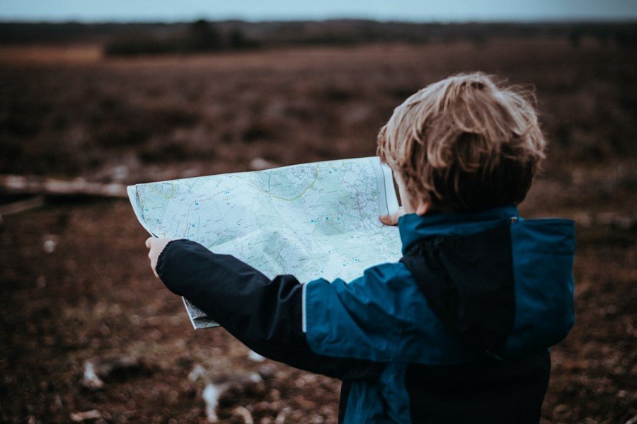
Students of today have grown with technology, so understandably, they are quite tech-savvy. Ask them for directions, and they’ll use the GPS on their device to help you. But, give some students big, geographical maps of us – and they’re completely lost.
Technology might make many of the things we did obsolete, but spatial thinking is definitely not one of those things. Reading different types of maps goes beyond merely being able to get from one point to another on a daily basis. By learning how to read maps, students develop spatial reasoning skills that allow them to, literally – take their own place in this world.
Ultimately, when a student develops spatial skills, they gain the capacity to understand the relations between symbols, pictures, objects, visualize them, or understand their relationship and distance. Without any doubt, learning to read a map helps students in building this important skill, the same as an efficient service that helps them build their research and writing skills.
Tips to Help Students Build Mapping Skills
Now that we have acknowledged the importance of mapping skills, here are some of the best ideas for helping students do this.
1. Get Rid of the Compass
Compasses and GPS are extremely helpful and everyone should learn to use them. But, before we hand these to students, we need to teach them about maps. So, don’t start a student with a compass. If you have, take it away. Relying on a needle to do all the work in determining spatial relations is not a smart idea.
Once the child has a solid understanding of how maps work, they should be taught to use compass and GPS devices.
2. Start with Small Maps
Whatever is taught, it’s always best to start small. Children need to get used to the idea of reading maps before we hand them a huge map. Thankfully, there are many maps we all have at our disposal, especially now that we have access to technology.
The maps used to teach a young student spatial relations should be kid-size. Then, students can move onto bigger and bigger maps.
3. Teach them the Symbols
A map can hardly be understood if the student doesn’t understand the symbols it contains. They might not understand every symbol they ever see on a map, but there are some basic symbols that everyone should know.
Of course, no one can memorize these all at once. Lists have to teach in stages, especially to young learners whose attention span is very short. Unless you want the child to give up because they feel overwhelmed with information, you have to do this gradually.
The first things taught in map reading is how things are showed on maps, such as water, roads, wooded areas, etc. Students should learn the difference between rivers and lakes, study different contour lines, as well as learn what footpaths look like.
There are even games that can help speed this process up and make it more fun for the students, such as map symbol bingo or different map quizzes.
4. Get Them Outside
Once they learn the basics, it’s time to put that knowledge into practice. Areas filled with hills are perfect to make the student better understand the complex things such as contour lines and landscape.
You don’t have to go far to do this, and it doesn’t even have to be the educator. Everyone contributes to the building of the spatial skills in a student. Pointing out things like hills and lakes can help. When you combine this with map reading, it makes for a fun and interesting exercise.
How does this work?
It is very simple. You show two or three hills that are close together from the window or while outside. Then, you ask the student to find these on the map. It should be much easier if there are multiple hills adjacent to each other.
Then, you can move onto exercises like finding their current position, find a specific position on a map, or tell you how you can get from your location to the desired location.
Conclusion
Reading maps can be daunting for a student who is faced with the task for the very first time. But, with some fun and practice, this can become a very interesting lesson and a very useful study material. Reading map builds a very important skill – spatial skill. This skill is crucial for any student and has to be taught at some point, preferably at an early age.
Author’s Bio
Jeff Blaylock is a geography teacher at a secondary school in New Jersey. His passion is to travel the world. Jeff is in touch with technology, which is why you can find many of his travel journal and amazing photography online.