Topographical maps are detailed maps that use contour lines to show the appearance of the earth’s surface. These maps accurately represent earth features like roads, buildings, railways, and mountains, among other features. Therefore, topographical maps illustrate any natural or artificial geographical feature on the earth’s surface. Other than locating artificial and natural features, topography can have several applications.
1. Architecture Planning
Topographical maps have vast applications in the construction field. During the initial stages of construction, these maps are used to survey the topography of the land in question and the condition of the soil. Engineers rely on these maps when deciding and choosing the best place for carrying out their architectural works.

2. Determination of gradient
The gradient of the ground plays a vital role in supporting civil engineering works. To determine the slope of the land, civil engineers use topographical maps to check the elevation of two points in the area of interest. In addition, these maps are essential in analyzing the parts of the land that support civil engineering works.
3. Examining Natural features
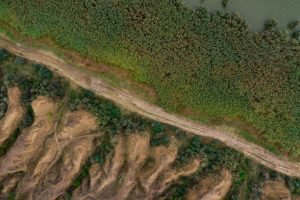
Studying and analyzing natural features is a key area of study in geography. However, studying and analyzing these features without topographical maps would be challenging.
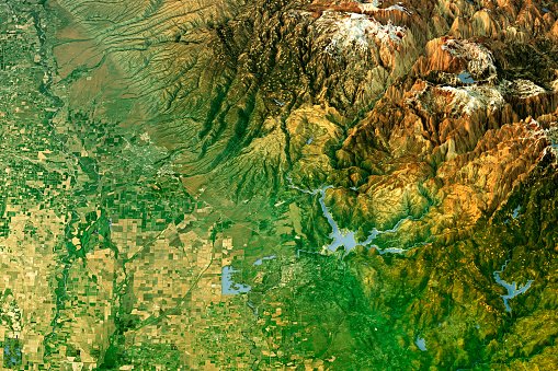
4. Locating Dams
With topological maps, it is easier to identify the water catchment area. There are watershed lines in these maps, representing the drainage area. Therefore, the information is useful in determining areas suitable for carrying out civil engineering works. In addition, these maps can be used to determine the capacity of reservoirs.
5. Recreational Purposes
A topological map is an excellent exploring tool. Before traveling to unfamiliar places, you must have a topological map. When using this type of map, one can easily locate the recreational areas in a given area. Similarly, one can approximate the distance between their live locations and the feature.
6. Military Field
Topological maps define the political boundaries of a given area. Military forces rely on these maps to know the boundaries of their countries. This helps them in executing their tasks. In addition, the military use these maps to examine field wars and other insecure areas.

7. Creation of 2D maps
2D maps are maps that have two 2-dimensional images. Topological maps are essential in making such images.
8. Making atlases
Atlases are booklets that contain geographical information. A topological map is a critical spatial data source in the atlas-making process. Besides that, in cartography, topological maps are helpful in mapmaking.
9. Land Documentation
The process of documenting a given land employs numerous components. Topological maps, for example, has a huge role in determining the nature and terrain of the land in interest. Therefore, these maps provide helpful information that can be used to analyze a given land.
10. Geological Survey
In Geological Survey, a geological survey shows the distribution of minerals and other geological materials. These maps aid in locating the mineral sites and new mineral grounds.