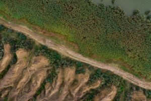
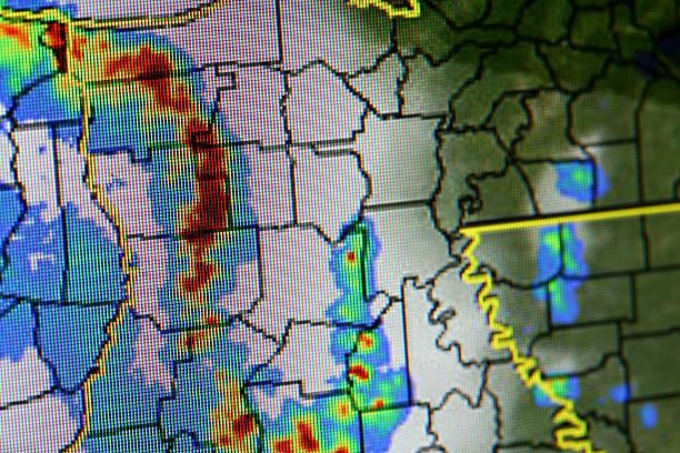
As its name suggests, thematic maps illustrate the relationships between themes (subject) and the selected area. It shows a specific topic’s spatial distribution and geographical patterns (themes). Before producing these maps, an area is selected, and the subject matter is determined. An excellent example of a thematic map is a weather or soil map, which focuses on a specific topic (weather and soil, respectively). The primary purpose of these maps is to explain something in detail; therefore, these maps have several applications.
They include:
1. Confirming Hypotheses
Thematic maps are detailed maps of a thing or location. Therefore, these maps can be used to answer why and how questions. One of these maps’ most significant applications is confirming and approving a hypothesis.
2. Cartography
Like any other type of map, thematic maps are critical in mapmaking. The spatial data found in these maps lay a rigid foundation in mapmaking and provide cartographers with the required information. In addition, in the atlas-making, these maps play a vital role.

3. Revealing Relationships
The thematic maps are concerned with only one subject matter. For example, a thematic map may only contain information about weather patterns or towns. The spatial data in these maps is essential in arriving at a conclusion and revealing the relationships of the maps’ themes. Additionally, these maps save the reader from confusion, as there are few components in the map.
4. Data Presentation
The goal of most research is the presentation of final thoughts and conclusions. Thematic maps are no exception. Cartographers and researchers use these maps to plan their data presentation on the selected subject matter. As a bonus, it is easier to analyze spatial datasets using these maps than other types of maps.
5. Synthesizing spatial data
The thematic maps are helpful in the data synthesis process. Data from multiple sources are combined in data synthesis to create a single source to understand the relationship and commonalities of diverse themes. Here, the spatial data in the thematic maps combine with other data sources to make a more complex data sued for analysis.

6. Themes documentation
When studying a specific subject matter, cartographic tools are powerful. In thematic maps, cartographers only research a research topic. The spatial data collected using the technique provides the relevant information needed for document-making.
7. Exploratory data
The thematic maps are essential in analyzing and grouping natural features. Studying and analyzing natural features is a crucial area of study in geography. However, researching and analyzing these features without cartography knowledge would be challenging. Today, geographers can have a copy of natural components on flat surfaces like maps.
8. Estimating Distance
Location-based thematic maps are the best for estimating the Distance. These maps have only data associated with the position of the areas, and therefore you can easily compute the Distance between two points. In addition, the spatial data found in the thematic maps help define the relationship between the two locations.