The global positioning system or the GPS is made up of satellites that are constantly orbiting the earth transmitting signals that are received by anyone in the world with a GPS receiver. GPS has a variety of applications in different areas different from forestry. In forestry however it can be used in; fire prevention, aerial spraying, fire control, harvesting operations, determination of boundaries, mapping systems, wildlife management as well as insect infestations.
1. Aerial spray application
GPS has qualities such as accuracy, identification of the correct positions, and boundaries that have enabled it through the years to be used to apply herbicides fertilizers and insecticides efficiently. The use of GPS enables good boundary marking hence ensuring there are none targeted areas that are not interfered with.
2. Mapping systems
GPS mapping systems are applied in the forest to help users with access to a phone or a laptop to get locations through a moving map display. This system is the same one encrypted on smartphones for easy location identification.
3. Fire Control
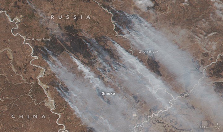
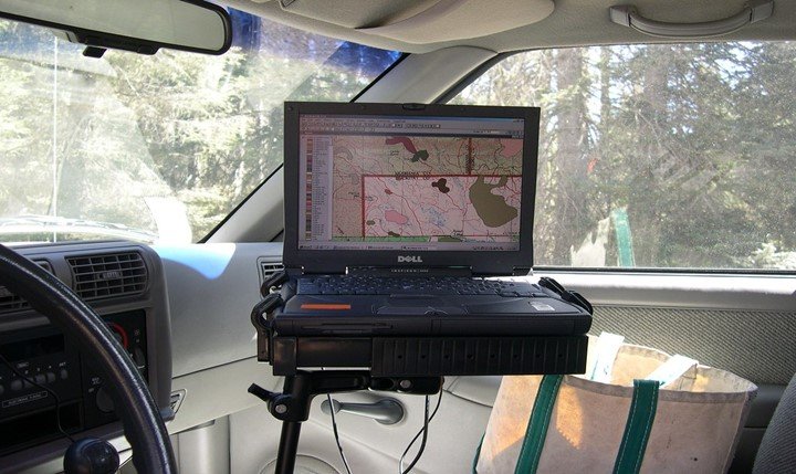
Wildfires have been reported from time to time with their known destruction to the environment and property. Thanks to GPS this disaster is controlled in such a way that, it creates maps that help the personnel on the ground to assess the damages done. GPS is used to locate the possible hot spots within a few minutes which is then transmitted to the personnel on the ground.
4. Harvesting Operations
GPS, in this case, is used to track the movements of the forest machine movements. The process of tracking these machines has enabled the forestry officials to understand how the forest machines are used together with their transportation network. Besides the GPS is helpful due to its accuracy and most of its information helps to create maps.
5. Single Tree Selection
GPS has been successfully been applied in the single tree selection system in Japan due to its ability to locate the exact geographic location of the marked trees. GPS generated maps and GPS handheld receiver have all been used to aid the tree marking and selection.
6. Location of sample plots in forest stands
The ability of a GPS to find the exact geographical positions is used in this case. The GPS helps the forest personnel to navigate through dense forest canopies.
7. Navigation for aerial surveys

GPS can be fixed in a helicopter which can help identify boundaries of a forest fire. The GPS can also be used in identifying the trees most likely to get damaged by the fires. Besides the GPS is used by researchers and forest personnel to collect data and navigation.
8. Wildlife Management
GPS is well known for its accuracy and ability to show the exact position of any target. In this case, GPS is used to trace the movements of wildlife and their activities over time.
9. Insect Infestations
Through the GPS waypoint navigation, the forestry personnel easily determine the insect infected areas that are they get the exact positions as well as their positional boundaries.
10. Determination of boundaries
Boundaries may be in terms of forest fires boundaries, insect infestations boundaries, wildlife boundaries, and more. GPS either on laptops, in helicopters, or phones easily locates the boundaries of the above mentioned.
In conclusion, GPS technology has proved efficient in helping out the forest personnel most especially in managing possible disasters and locational and navigational work easier.

simon
26 Jan 2023we are looking at gps for how forestry business and would like to talk to some one at gps for the forestry work we do