GPS has in the last years been intensively used as receivers for directions and as navigations app that tells us where we are and how to move between points. They have also been used to make digital maps. However, GPS apps are not only used by civilians but also by different organizations for different purposes. For example, it is useful to pilots, surveyors, farmers, boat captains, military and scientists among others. Apart from the usually GPS that we use in our phones, other highly advanced apps are incredibly accurate and are used for specific tasks in different industries. Some of the industries that use this application include;
1. Aviation
Most of the modern aircraft use GPS receivers to provide the pilots and passenger with real-time aircraft position. They also provide a map of various destinations depending on where the aircraft operates. This application is also used by the airline operators to decide which route is the fastest, safest, and most fuel-efficient among the destinations. They also use the app to track the aircraft and direct the pilot in the case where there is a change in the weather conditions or any other issue that may arise.
2. Marine
Highly accurate navigation app is needed by boat captains to enable them to navigate through waters to their destinations. These applications ensure that the channels are clear and there are no obstacles that can hinder their navigation. They are also required in the marine departments since they are used to map and position dredging operations in rivers, sandbars, and wharves to ensure that other boats are aware of how deep they should get.
3. Farming
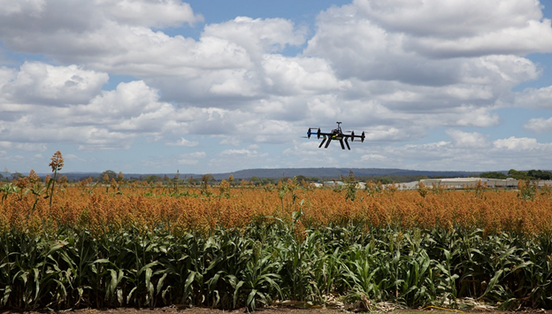
Farmers have a specific season for planting, weeding, and harvesting, and due to the repeat in the seasons, they put the GPS receiver on their tractors and other farming equipment. This allows them to map their plantations and ensure that they return to precisely the same time when planting or weeding in the next season. This strategy is effective especially in seasons when it’s foggy with less visibility since the machine will still operate since its GPS and not visual reference guides it. More so, its high accuracy makes it suitable for use in mapping soil sample locations, and the farmers can locate the areas that have soils suitable for farming.
4. Science
This is one field that intensively uses the GPS app especially since there are numerous braches and departments in the science field and this include physics, biology and earth science to mention a few. Before the invention of this app, scientists used metal and plastic bands to tag animals, and they would follow them to various location while monitoring them. However, since the invention and enhancement of the navigation app, it has helped scientist to fit the animal with the collars and the app can automatically record the animal’s movement and the information is transmitted to a through a satellite to the researcher. This means that they can trace the location of the animals’ movement without having to relocate them physically. Most of the sciences taught in schools will have more practical evidence especially since GPS provides accurate data. Earth scientist also uses the app to study how landscapes change over time. Or any geographic area that they may be interested.
5. Surveying
Surveying is one of the uses of GPS that are essential especially since it is used in mapping and measuring various measures on the earth surface and underwaters. It is used in determining land boundaries, mapping sea floors, and highlighting the changes in the shape of structures. The best thing about high accuracy GPS app is that the surveyors can set it up over a single point and establish a reference marker. They can also use it in a moving configuration to map the boundaries of particular features. With the data obtained from the application, they can easily key in the details into a software that will help them offer their customers with a detailed chart.
6. Military
The US Department of Defense was the first to develop the GPS app system, and since then the system has been adopted by numerous military forces around the world. Other countries have even decided to develop their satellite navigation networks as a defense mechanism during war times. Today, there has been a diverse use of the app, and it can be used to map the location of vehicles and other machinery such as missiles during a war. This is a technique used purposely to protect the soldiers and also manage resources.
7. Financial Services
Financial organizations such as banks use this app to schedule and determine local and international money transfers. They are also using it to provide audit trails of financial transactions. More so, since more than 80% of the transactions are made through debit and credit cards, it has been easier to provide a higher level of timing accuracy. The GPS satellite is necessary for the financial field since it allows for data and time stamps of Electronic Funds Transfers.
8. Telecommunications
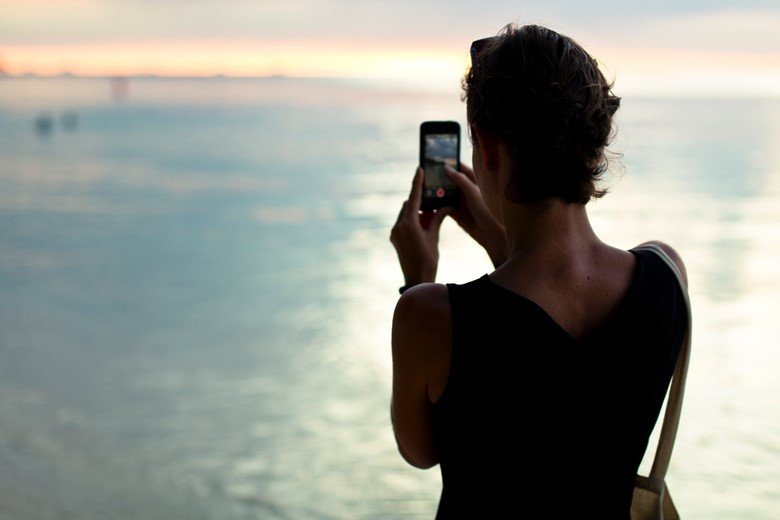
Telecommunications especially the mobile telephones use this app to provide its users with accuracy, reliability, and stability of their operations. Although other clocks can provide this, the GPS supports the derivation of synchronized time zones with the help of the satellite signals.
9. Heavy Vehicle Guidance
Heavy tack machines used in mining and constructions also use this technology. For example in highway construction, the marker pegs and surveyors have been replaced by the improvised in-cabin vehicle guidance and control systems. This makes the work easier since the driver only needs to follow the surveyor’s pre-programmed site plan. Thus, with this app, the constructors can achieve close tolerance for position, gradient, and level.
10. Road Transportation
Majority of users of this technology are taxi services, emergency vehicle location, commercial fleet management and freight tracking, public transport monitoring, dispatch, and navigation. Private car owners also use the app, and most of the new car models come with a factory-fitted GPS.
11. Social Activities
Some of the social activities that have incorporated the use of this technology include cross-country cycling, skiing, hiking skydiving, paragliding, geotagging photographs, geocaching, geodashing among others.
12. Locating Positions
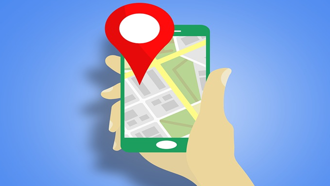
GPS navigation system is commonly used to designate positions. It is used by travelers, researchers and the everyday citizens. More so, you can use it to locate websites that offer certain services in your country. Certain websites block access by people from a specific location. For example, if you are looking for a website that offers academic assistance in your area such as online custom writing service, then as long as your GPS location is allowed into the website, you will get a list of recommendable website.
13. Tracking for Law Enforcement
The police also use it during investigations to catch suspects and criminals. They also use it to keep track of people who feel that their lives may be in danger.
14. Locating Your Pets
Pets such as cats and dogs can easily get distracted and go missing. A GPS microchip will help you locate your pet’s whereabouts.
15. Keeping Watch of the Elderly
Some elderly people don’t like when someone monitors them and they at times wander alone in unfamiliar places and may find it difficult to trace their way back home. Or maybe one may fall down and may need emergency medical assistance. This device can be used where, if they need any help, they only have to press a button, and the caregiver will be alerted.
They come in tiny units that can be used on their clothes. Some are also wearable watches that are not conspicuous.
16. Seeking Treasure
Uses of GPS are intensive, and tech-geeks also use the technology when hunting treasure with friends. The clues are hidden in sites programmed on treasure maps, and these apps are uploaded to a particular website where people join and compete for the prizes.
17. Securing Artworks
Some paintings worth millions and are susceptible to theft. Although some are insured, owners also use trackers as additional security to help them locate them when stolen.
18. Solo Travels
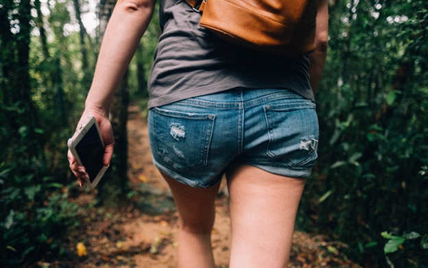
When traveling to a location that you are not familiar it is advisable to have a tracker with you to alert people when you face any dangers or get lost.
19. Hunting and Fishing
Using this technology allows you to mark the spots that you would want to return to your next hunting or fishing trip.
20. Easy Access to Emergency Roadside Support
In case of an accident or an emergency, you can seek assistance using the pre-programmed emergency numbers on your smartphone. The best thing about using this app is that the emergency crew can trace your current location without having to provide any details.
21. GPS technology combined with Intelligence Vehicle Highway Systems is used to improve highway safety and ease congestion
Integrated Traffic Management Systems requires accurate data that is available in real time. This is to ensure that the necessary authorities can manage the travel time and speed to monitor and control congestion. Thus, the GPS is used to collect the required data, and it has been proved to be 50% more efficient in terms of manpower.
22. Public Safety and Disaster Relief
The best thing about GPS is that it can be used in any weather or environmental condition which is the reason why is preferred for use during disaster management. The emergency vehicles and supplies are tracked using GPS.
23. In the Robotic field
Just like GPS provides direction to human, the same case applies to robots. GPS enhances navigation of mobile robots and makes them applicable to diverse fields such as outdoor industrial work, mapping, and agriculture.
24. Can be used by Disabled People
People with special needs are at times left on their one when their caretakers and loved ones have to work. The GPS tracker is not only used to track their location, but it can be of great importance in the case of emergencies.
25. School Bus Tracking
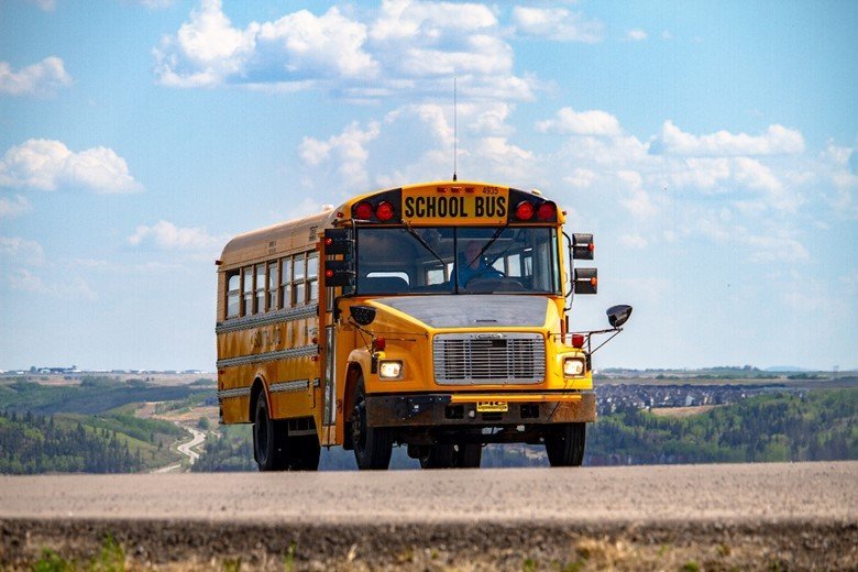
School Bus GPS tracking system is used in gathering information about which route is most efficient. It also provides the bus drivers with real-time directions whenever they get lost. School management can use this technology to ensure that the bus drivers follow the authorized routes and that they do not take unnecessary breaks during working hours.
26. Trailer Tracking
GPS trailer tracking system is an important aspect that improves security and increases efficiency as well as reduces costs. The management uses the GPS app tracking system to monitor their fleet and equipment. It also provides accurate and detailed reporting which gives the owner peace of mind.
27. Boat Tracking
Boat tracking system protects your boat from being stolen. Installing a navigation app allows you to see the location of your boat in real time. More so, there are systems that enable you to see its fuel consumption. This technology not only gives you peace of mind but it also allows you to effectively schedule the hours of delivery and the route that is fuel efficient.
28. Business Tracking
This tracking systems have been used by various businesses ranging from small, medium and large organizations to remain competitive. The technology provides business owners with real-time information about their business and other relevant information. The devices vary depending on the business, but there is a whole lot of advantages that a company can obtain from using a business tracking system.
29. Live Recording
Live streaming video and tracking are other uses of GPS app, and the best thing about it is that it offers real-time data and you can record activities as they happen and through the transmission, through the satellite, you can view the happenings million miles away.
30. Speed Monitoring
GPS tracker provides accurate speed estimates of vehicles or fleet which are transmitted to a central hub where they can read in real time and recorded for future reference. Keeping track of speed allows you to reduce the cost of fuel consumption, a lesser number of speed tickets, reduces the rate of accidents, and minimizes wear and tear on your vehicle.
31. Graphics Reporting
The navigation app is useful in providing a graphic report of the occurrences as they happen. This could either be the distance covered or the fuel consumed.
32. Geo-Mapping and Landmarking
This system provides integrated and accurate landmarking and mapping information. It is known to be highly accurate and faster than any conventional strategy. There is minimal labor required and less amount of equipment to be used.
33. Making Electronic and Rough Topographic Maps
This app is effective in creating coordinates for contour and topographic maps. The best thing about using GPS is that it is accurate, convenient and can be used in any location without requiring much supervision.
34. Tracking Luggage and Laptops
You can install a GPS tracking system on your luggage or laptop which will help you locate them in case they are stolen.
35. Track Family and Friends in Crowded Gatherings
When visiting places with huge crowds, it is easy to get separated from your loved ones which could be scary. In this case, carrying a tracking system will help track where they are with ease.
36. When Going on a Vacation
It is easy to get lost when traveling to a new location. More so, your map might be complicated to read in which case; a navigation app is more recommendable since it not only gives you accurate data, but it can also be used to alert rescue service agencies in the event of emergencies.
37. Listening to Hidden Conversations
There are certain monitoring devices that are capable of listening to private conversations through audio recording. This is mostly used by government agencies who have the authority to do so. They may implant recording devices in your house, office or car which have GPS to trace your movements.
38. Accessing your Vehicle from Mobile, PC or Tablet
Linking up your vehicle tracking system to your mobile device enables you to monitor the location of your vehicle in real time. This is useful when your vehicle has been stolen or when you lend someone your car.
39. Immobilizing The Vehicle In Case Of Theft
Certain tracking systems allow you to immobilize your car if stolen. This app will shut the vehicle even when it’s in motion and will help you to get back your vehicle with ease as well as give you peace of mind.
40. Setting up a Geo-Fence
GPS technology has not only enabled us to track and know directions, but it has also been utilized in geo-fencing which alerts you whenever a person or object enters or exits from a chosen area. A Geo-fence is a virtual border that is set up within seconds and you are notified through text or email whenever a GPS tracker crosses the chosen region.
41. SOS Alarm in case of Emergency
The SOS alarm utilized the navigation system that can be installed in either your mobile phone or computer and that notifies you when your loved one presses it. You can use it for your children or the elderly.
42. Direct Fault Motion Measurement in Earthquakes
This app is also used in measuring earthquakes by measuring the millimeter-scale movements of the crust between earthquakes. Although it does not measure the actual shaking of the ground caused by the earthquake, it records displacement of stations during earthquakes.
43. Nearby Area Searches Such as Hotels, Hospitals, Oil Stations, and Government Offices
It tracks your location and provides you with information and data of the area you are scanning. You can search and book a hotel near your area, and the best thing about using this app is that it is accurate and provides real-time data.
44. Tracking Environmental Disasters Such as Fires and Oil Spills
It is efficient is tracking disasters conditions in real time which could have taken much time without its application. Fires and oil spills can happen in areas with adverse weather conditions, and it is essential to monitor the location so as to offer fast relief.
45. Improving Accuracy of Weather Forecasts
Upholding the accuracy of the weather focus is among the many uses of GPS. The technology is used in projecting temperature levels both on the ground and that of the atmosphere.
46. Has Made Aerial Studies Much Easier and Effective
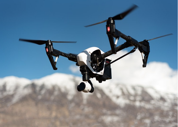
Aerial studies are one of the most impenetrable studies that have been boosted by the use of GPS. It has been intensively been used in studying wildlife, terrains and human infrastructure. This has been made possible by tagging imagery with the help of GPS coordinates.
47. Monitoring the Migration Patterns of Endangered Species
It is easy to use the app to identify the migratory patterns of endangered species, for example, the mountain gorilla of Rwanda. This can help prevent their reducing populations.
48. Efficient Management of Logging in Forests, and Delineation of Borders
The use of mapping information is used to control logging in forests. The navigation app provides real-time data of the happenings in a certain region and authorities can use to monitor any delineation in their borders.
49. Helps Solve Disputes between Landowners
In the case where there are border disputes, this app is used to provide unbiased geographic borders according to the existing information. It provides accurate coordinates and directions.
50. Gathering Accurate and Timely Information
Providing accurate and timely information is one of the primary uses of GPS, and the app has been intensively used to provide location and directions among other uses as discussed above. Its accuracy has seen its intensive use in fields such as military, agriculture, mining, surveying among others.
There are many uses and application of GPS as discussed above and the system’s information is available to anyone and anywhere with no charges. You only need to get a receiver to access the data. This technology is useful in any industry in the world, and it impacts our lives in various ways some of which we may not be aware of.


Fleet go
6 Sep 2018Uses or benefits are required to be known by everyone of any device we operate in daily life. The article explains the uses/applications of the GPS system in detail and is very knowledgeable. These 50 points give all the information we required so that we can use the system applications in the correct way.
admin
9 Sep 2018Thank you
Jewel Ahmed
11 Nov 2018Many modern vehicle tracking devices combine both active and passive tracking abilities: when a cellular network is available and a tracking device is connected it transmits data to a server; when a network is not available the device stores data in internal memory and will transmit stored data to the server later when the network becomes available again.
alvin
13 Nov 2018can I please have some reference/s or cite sources?
Thankyou
alvin
13 Nov 2018Can I please have some references?
Md Shahabuddin
5 Jan 2019Many modern vehicle tracking devices combine both active and passive tracking abilities: when a cellular network is available and a tracking device is connected it transmits data to a server; when a network is not available the device stores data in internal memory and will transmit stored data to the server later when the network becomes available again.
Estino uzor
31 Jul 2019Thank u very much, very interesting
Robert Graham
22 Aug 2019#37 is not a use of GPS. Listening devices have been around a long time before GPS. Having a location associated with an audio recording can be valuable.
Valentine T Nhopi
13 Sep 2019Thank you so much , but there is need for more editions especially on application of GPS in environmental studies
Laura
28 Feb 2021If someone put a gps tracker on your veh. And is tracking you w/o your permission, it is called stalking. Do you have for sale a tracker reader that someone can buy, to find and remove gps tag?
Eddie Thompson
16 Jun 2021This is very helpful! Thanks for this! You may also want to look up Infiniti tracking as they are one of the best when it comes to GPS tracking services. https://www.infinititracking.co.uk/product-category/car-trackers/
Marc Galyon
26 Dec 2021Great article. I have been using GPS for a long time, but had no idea that there are so many applications and uses of GPS. It is really interesting to know all these new things about GPS. Thanks for sharing this useful information with us!
Adam Dever
28 Apr 2022Extraordinary article. I have been involving GPS for quite a while, however had no clue about that there are such countless applications and utilizations of GPS. Knowing this multitude of new things about dissertation help services is truly fascinating. Much obliged for offering this helpful data to us!