Since the beginning of civilization on the planet earth, Military forces have played a dominant role. Mankind has since time immemorial has a fetish for warfare and this continues till today. Only methods have changed with technology used in warfare, which is changing rapidly with technological revolution, which has not only changed the way wars are fought but has become a key factor in attaining dominance in military power. The military has continued to implement processes and technology that would advance their military prowess during wartime with limited causalities and minimum costs. Below are some of the applications of GIS in the military.
1. Defense Estate Management

The value of this GIS technology as an administrative support is significant, particularly; the MOD holds large chunks of property across the nation. Effective management of the Defense Estates requires significant effort. In this background, the MOD with its three wings of Armed forces is served by mapping both digital and analogue which is consistent and accurate in all aspects.
2. Terrain Evaluation

In land based military operations Military field commanders would like to know terrain conditions, elevations for maneuvering armour carriers, tanks and for use of various weapons. In addition, they need vegetation cover, road networks, and communication lines with pin pointing accuracy for optimizing the resource utilization. A detailed land map with information on the land use, terrain model and proximity of habitat are essential for military operations. All these details must be available to the field commanders on a datum to match with the equipment he uses for position fixing and communication in his area of operation.
3. Viewing Spatial Data
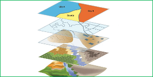
Most potential users of GIS are viewers. There are personnel right from field commanders to command staff. They need access to a geographic picture, map or photograph to help and assess a situation to carry out planned operations. Earlier GIS packages are proprietary in nature and were restricting the use of data within its confined specifications. A comprehensive database in multi-type data integration background needs an open GIS approach.
4. Naval Operations

At sea Naval vessels depend largely on indirect methods to navigate when there is no means of establishing their position with visual aids. Global Positioning System (GPS) provides the means of determining the position at sea. Echo sounder provided measurement of the depth of the water below the vessel. Naval vessels will be operating at sea using several electronic gadgets for operations. Recent technological advances have provided the means to assess the unknown to greater accuracy. In the Oceans, complex natural features such currents, wave conditions, sea surface temperatures and tides may prove at times deterrent to naval operations.
5. Air Operations

Air operations in battle environment require the similar inputs as per land operations along with precise height information for targeting. These include the detailed information about the target location, proximity of civilian areas, and terrain evaluation and meteorological conditions besides navigational data. The virtual reality concepts are of greater help in fighter and bombing aircrafts for effective air strike operations.
6. Weather Information
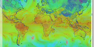
Weather plays dominant role in the battlefield. Real time weather information is essential for field commanders either on land or in sea or in air for successful completion of the task. At times, weather may play crucial role in success or failure of an operation. Every battlefield commander would like to know the information regarding cloud coverage, wind conditions, visibility, temperature parameters and other related inputs.
7. Defense Camp Site Management
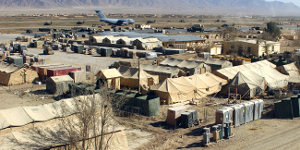
Use of GIS in the management of military bases facilitates maintenance and the tackling of all stores, which may be found on the base. GIS allows military land and facilities managers to reduce base operation and maintenance costs, improve mission effectiveness, provide rapid modelling capabilities for analyzing alternative strategies, improve communication and to store institutional knowledge.
8. Terrain Evaluation In land based military operations
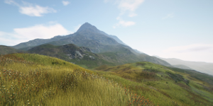
Military field commanders would like to know terrain conditions, elevations for maneuvering Armour carriers, tanks and for use of various weapons. In addition, they need vegetation cover, road networks, and communication lines with pin pointing accuracy for optimizing resource utilization. A detailed land map with information on land use, terrain model and proximity of habitat is essential for military operations.


Stephen Kiboi
28 Jun 2018Am glad to get that information .It will help me in my studies and would like to be am Gis military expert and join military in Kenya
moses njue
6 Aug 2019This stuff was excellent. Looking forward to a military based application gis project for my final year.