A geographic information system, or GIS, provides a central database storing every piece of data your landmen, equipment, and operations generate and turn it into actionable information.
Here are 30 ways you can use GIS data to improve your oil and gas business.
1. Prospect Analysis: Use GIS to estimate hydrocarbon reserve or volume as well as estimate reserves. Perform raster analysis based on a deterministic prospect volume of petroleum and reservoirs and spatial analysis of well data in unconventional hydrocarbon sources such as shale.
2. Data Acquisition: Acquire data for your plan survey, including restricted vs. accessible areas; farm boundaries, cities, and roads; and the potential for the use of dynamite or vibroseis. Create seismic, gravity, magnetic, and tomographic visualizations from the data.
3. Data Interpretation: Generate maps and visualizations of data for data interpretation. Create a 3D data tie and visualization. Generate surface maps including satellite imagery. Develop gravity and magnetic maps as well as seismic subsurface grids and maps from a complex collection of data.
4. Data Index Map Creation: Deliver effective digital maps for oil company staff to use to see the data that is available. They can use the data to significantly reduce the time spent on information seeking to perform their work. These maps are often available via web-based GIS applications that are extremely intuitive and user-friendly, requiring little training. All data of interest is shown side-by-side in a single user interface or dashboard.
5. Automated Map Production and Visualization: GIS provides a data-driven method for creating maps of multiple sites. Efficiently route service trucks and other vehicles and stakeholders.
6. Exploration Survey: For onshore surveys, generate a visual framework for exploration across all your assets. You have access to 3D modeling of geophysical, geological, and petrophysical hierarchical data. Offshore, utilize bathymetry mapping and access seafloor surveys. Define shipping lane maps with data integration. Perform a 3D seismic analysis and use on-demand satellite image processing for offshore exploration and mapping activities.
7. Thematic Maps: Create and display a variety of thematic maps using the substantial data set within the GIS. You can create choropleth, proportional, isarithmic (contour), dot, and dasymetric maps for virtually any use. Thematic maps are a form of data visualization that can show quantitative data in color representing density, percent, average value, or quantity of an event within a geographic area. Sequential colors represent increasing or decreasing positive or negative data values or a range of values. Isarithmic or contour maps use isolines to show 3D values for elevation or other information types for topographic mapping.
8. Acreage Analysis: With a GIS, you can evaluate and grade opportunities rapidly from a multi-disciplinary asset data set. Assign weightings and criteria, rank acreage, leases, companies, and blocks. Explore statistics on a visual platform.
9. Basin Analysis: Map the potential hydrocarbon accumulations. Perform hydrological modeling and subsurface secondary fluid migration network mapping. You can visualize flow direction and flow accumulation mapping across DEM as well as potential migration paths.
10. Play Analysis: Map risk segments for each petroleum play element. You can also map regional risk and generate geological maps. Perform ground truthing or develop validating imagery with field survey data.
11. Block Ranking: Block ranking is a quantitative analysis method used for ranking opportunities that are more efficiently performed with GIS than manually. Assess oil and gas lease blocks or licenses and grade them to mine substantial quantities of various data types to simplify the decision-making process. Block ranking is especially effective when competing for license acquisitions.
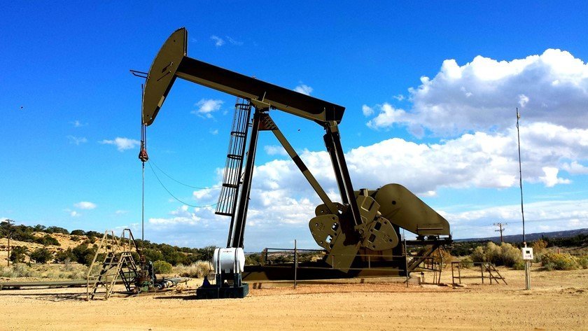
12. Well Planning: Well planning has been complicated with the increase in unconventional hydrocarbon resources such as shale oil and gas as well as coal bed methane. GIS assists in planning well pad patterns around multiple surface drilling constraints. The spatial analytics optimizes drilling patterns to find the most efficient configurations and optimizing workflows.
13. Pipeline Management: Track inspections with remote data. Analyze spatially dispersed data in real-time and access seafloor geodesy and asset management data offshore. Monitor your pipelines for geohazards and leaks.
14. Pipeline Routing: Determine the optimal path to build pipelines to carry petroleum products. Produce a least cost path analysis and network analysis for environmentally friendly and cost-effective routes. Least cost path analysis identifies the route with the fewest obstructions between a source point and the delivery destination. The analysis is based on the effort required to move through the cells in one or more raster datasets such as slope and landcover. Reduce costs by 15%.
15. Field Operations: Use flying sensor technology to gather on-demand imagery in high-resolution over a field location. Survey the site and regularly monitor your sites. Identify and manage any changes found. Using GIS for this purpose is much more cost effective than commissioning satellite capture data.
16. Distribution Management: Combine pipeline routing and management with vehicle and vessel tracking to plan and monitor all phases of hydrocarbon distribution. Visualize the complete journey from well to refinery to selling and distribution.
17. Drilling Operations: Survey the surface location, determine the type of rig, and acquire log data remotely. Geosteer the well to a precise target location and live stream the data to tie with subsurface work. Use spatial analysis within the GIS to optimize drilling patterns and configurations. Empower decision making for efficient and productive drilling operations with terrain analysis for seismic planning along with seismic survey maps and satellite image processing.
18. Asset Management: A GIS stores, collects and visualizes the physical location of each asset, including pipelines, wells, pump stations, and tank terminals. It also monitors non-spatial information such as the date and installation of pipes. Monitoring of non-spatial data helps you determine when there is a need for maintenance or repair.
19. Facilities Management: Accurately monitor associated environmental changes in near real-time for health, safety, and environmental compliance with the GIS-provided 3D layout. Remotely monitor emergency responses during oil spills, explosions, or leaks.
20. Land Management: Landmen use GIS data to map important lease information such as expiry dates, overriding royalty interest, overriding royalty, working interests, lessor names, and gross and net acreage. Centralize your land management data to generate reports to comply with regulators easily.
21. Vessel Tracking: Monitor valuable water-going assets with precise location to ensure timely delivery of goods and services. Vessel tracking also supports efficient emergency responses.
22. Vehicle or Fleet Tracking: Track mobile land vehicles to ensure timely arrival without incident. In disaster events, you can easily monitor the position and speed of each vehicle and the fleet as a whole.
23. Production Monitoring: GIS data analysis enables you to monitor your complete oil and gas business. Track well production, manage pipelines and facilities and manage your port operations to follow all oil and gas products as they move about the world.
24. Well Log Digitization: Acquiring well log data in a digital format improves overall efficiency. There is no need to keep paper logs, and everyone involved with a particular well has access to the same information every time. Updating multiple documents is not needed, decreasing the potential for error and the effort required to maintain the data.
25. Environmental Monitoring: Controversy has surrounded the oil and gas industry for years regarding its environmental impact. With shale development, it is crucial to monitor environmental changes accurately. Integrate and visualize time-stamped data against baseline such as routinely updated DEMs to detect subsidence caused by resource extraction.
26. Environmental Management: The variety of types of drilling and the length of the pipelines for distribution demands environmental management to ensure safety, and environmental regulations are followed and any issues resolved immediately. Monitoring environmental data and responding to identified problems quickly reduces lost costs and maintains the land for future use once drilling and distribution are complete.
27. Remote Sensing for Terrain Stability: Your GIS can receive, store, and manipulate data from satellite interferometric synthetic aperture radar, or InSAR. Monitor potential geohazards to understand when and where to deploy staff, increase safety precautions, and continue production. For further accuracy, remote sensing data can be compared to that from ground surveys.
28. Disaster Management: As you drill deeper into the ocean or deploy fracturing operations, the need for disaster management grows. Traditional drilling and field operations already require a wealth of data to maintain safety. Oil rigs in the deep ocean and shale production add to the complexity of data accumulated. GIS takes the mountain of data and makes sense of every need for repair and maintenance activity to mitigate disasters and minimize the resources required to recover.
29. Emergency Response: The faster you can respond to an emergency, the lower the impact on operations and the environment. Gathering and analyzing remote data within the GIS database is fast and easy, allowing your emergency response to hit the ground running with the right information at the right time.
30. Decommissioning: When it comes time to shut down operations and remove assets, GIS can analyze field data from earlier oil field life cycle phases and help you remove any infrastructure and assets placed. Recover the site for land use in record time and without anything slipping through the cracks.
As the need for hydrocarbon exploration and production continue to grow, despite inroads from wind, wave, and solar energy, the amount of data generated by these operations expands exponentially.
By automating your data storage and report generation, you can build more efficient and effective processes than in the past. A GIS is an investment that will return itself many times over, starting from your first well.
Author’s bio:
Paul Cones is the President of CourthouseDirect.com, an innovative technology company that provides legal record search products and services. Since 1982, they have offered the nation’s largest and most comprehensive repository of courthouse documents online.


Ghulam Hasnain
3 Feb 2019Thanks for sharing amazing stuff . Please write on GIS application in History too.
Yusuf Mohammed inuwa
13 Oct 2020Very nice idea