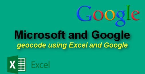
Geocoding using Microsoft Excel 2013 and Google Maps API
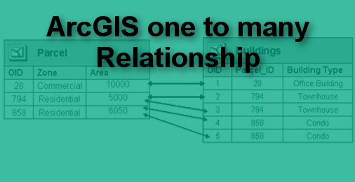
Geocoding is the process of converting addresses to the x and y coordinate or longitude and latitude. There are various option available in the market to perform geocoding, some are…
Today I thought I should write tutorial on ArcGIS. I am using ArcGIS 10.3 version but most of the command will be same for lower versions. This simple things if…
It has been while I have not written any blog due to my tight schedule. I thought to start blogging again as my work load has decreased. This week at…
ArcGIS Table of Content is a place where all layers and Dataframes are kept. Organizing layers and Dataframes make your life easier while editing and designing. Following are some of Tips and Tricks that…
I was trying to create the contour line from the PhytonGUI but failed to create it. It keep on showing me the error - 000824. Below code generates 25 m…
When you add the base map into the table of content (TOC) and want to export the map, then ESRI credit will be added in the layout. This credit takes away…
TileMill is used to create beautiful map for journalist, web designer, researcher, or seasoned cartographer. It is a design studio where you create stunning maps. Following are the features of…