Maps show us direction and beauty definitely add values to them. It tell us story, that is reflected if it is a good map. Map has become popular medium to convey information. Below beautiful maps are my collection, collected from different websites. If you find any maps that you thing is beautiful and aesthetic, please share with us.
1. Eduward Imof relief shading maps
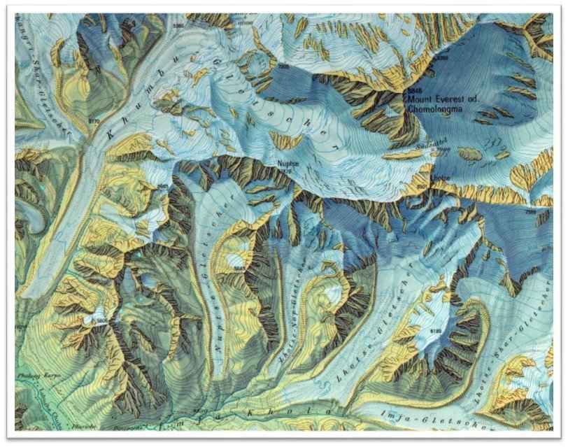
Eduward Imof Mount Everest hill shade map
Eduward Imof (1895 – 1986) was a professor of cartographer Swiss Federal Institute of Technology, Zürich, Switzerland. He was well known for his master piece relief shading maps.
2. Map of Britain from the Human Network Interactions
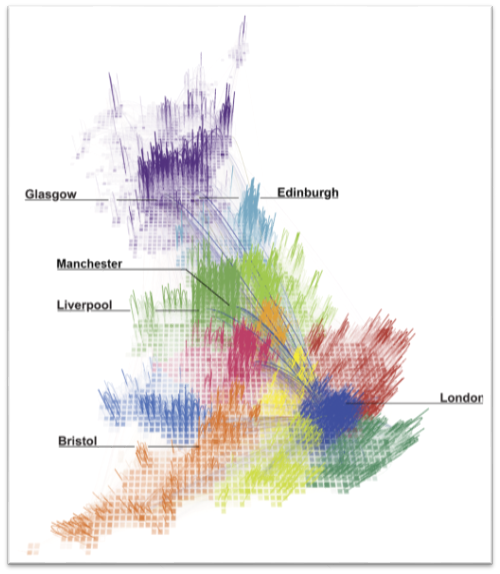
Fig: The geography of talk in Great Britain. This figure shows the strongest 80% of links, as measured by total talk time, between areas within Britain. The opacity of each link is proportional to the total call time between two areas and the different colors represent regions identified using network modularity optimization analysis.
An article is at the plos.org, Redrawing the Map of Great Britain from a Network of Human Interactions by: Carlo Ratti, Stanislav Sobolevsky, Francesco Calabrese, Clio Andris, Jonathan Reades, Mauro Martino, Rob Claxton, Steven H. Strogatz PLoS ONE, Vol. 5, No. 12. (8th December 2010)
Download original image: http://journals.plos.org/plosone/article/figure/image?size=original&id=info:doi/10.1371/journal.pone.0014248.g001
3. Jhon Ogilby Road Map
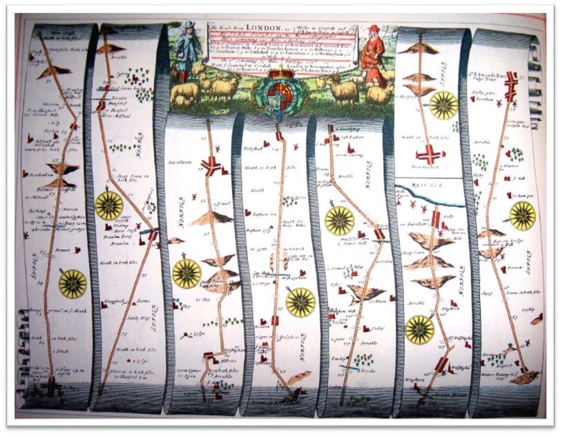
Britannia atlas, showing the route from Newmarket, Suffolk to Wells-next-the-Sea, Norfolk.(John Ogilby’s 1675)
John Ogilby (1600-16760) was a Scottish cartographer, translator and impresario. He is best known for his map of British road networks.
4. World Rivers
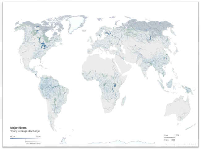
Map showing flowing fresh water (river). To see animation map, go to the national geographic
Food for thought, 97 percentage of water is salty, 2 percentage is tapped in ice and snow and only 1 percentage is fresh water. We use this 1 percentage fresh water for drinking, growing food, use in factory and more.
5. Dymaxion Map
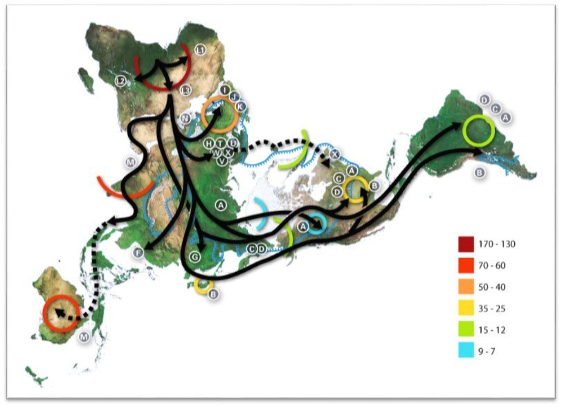
Example of use illustrating early human migrations according to mitochondrial population genetics (numbers are millennia before present). Map is taken from Wikipedia
The Dymaxion or fuller map is the type of projection of the world map on the surface of icosahedron (is a polyhedron with 20 faces). This icosahedron surface is unfolded and flattened into the 2D maps. This type of map preserve shapes and sizes but heavily distorted. The map was created by Buckminster Fuller.
6. Shanghai Web Map

This is pretty neat cool web map with 3D view of Shanghai city. Translate the Chinese language to English while opening the sites, this helps to navigate the map.
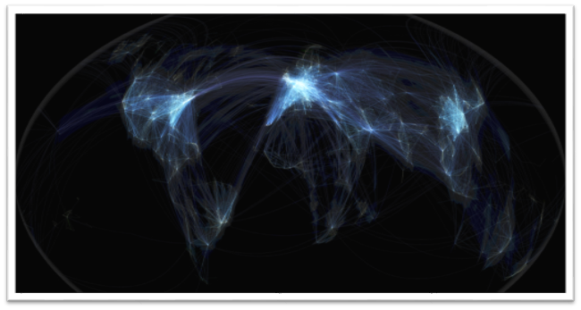
7. Flight Path Map

Michael Markieta, visualisations of flight paths crossing the globe.
More interactive images go to http://www.bbc.com/news/in-pictures-22657086
8. Atlantic Ocean Floor

Atlantic Ocean Floor
Browse map at http://mapsdesign.tumblr.com/image/100899574917
9. ESRI Map Book Collection

World Map from volume 24 page 12
Esri have hundreds of beautiful map collection, collected in the map book. You can browse or download map book. You have to pay to buy a hard copy map book. http://www.esri.com/mapmuseum