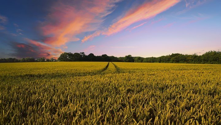
Farming provides the most basic needs of humankind. The availability of high-resolution satellite images, i.e., spatial, spectral, and temporal, has facilitated remote sensing in precision farming. Remote sensing in precision farming provides the tools and technologies to evaluate data necessary for improved farming practices and increased crop production. Data is acquired by remote sensors mounted on satellites, unmanned aerial vehicles (UAV), aircraft, or ground-based equipment. Some major applications of remote sensing in precision farming include:
1. Mapping Soil Properties
There is a need to map soil for sustainable management of natural resources at all levels, whether local, regional, or national. Maps depicting crop growth, crop diseases, weeds, crop nutrient deficiencies, and other crop conditions are required for the operational success of Variable-rate technology (VRT). VRT makes a variation of the rate of soil and crop inputs possible. As a result, these maps are acquired through remotely sensed images from sensors mounted on satellites, aircraft, or the ground.
2. Classification of Crop Species
Modern agriculture is getting better and better as time goes by. There is the development of different species of crops due to the increased devices and tools which support precision farming activities. Remote sensing techniques have been applied globally to aid in the decision-making and classification processes for different species of crops. Groups of crops include field crops, horticulture, viticulture, and pasture.
3. Crop Monitoring
Precision farming uses remote sensing technology to optimize agricultural inputs to increase production and reduce losses. Farming requires information on crop conditions frequently throughout the growing season. Monitoring crop growth is necessary to understand the crop’s response to the environment and develop effective management plans. Remote sensing data in precision farming estimates the biomass for various crops; biomass is an essential indicator of crop health and development.
4. Irrigation Management
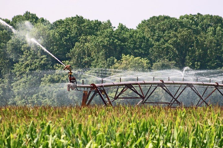
The time and amount of irrigated water play a significant role in mitigating crop water stress and achieving optimum growth. Remote sensing products develop and test multiple indices and techniques necessary for irrigation management. Images of growing plants collected by remote sensors estimate crop water requirements and their irrigation schedule.
5. Nutrient Management
The timely and appropriate application of fertilizers is essential to optimize crop growth and crop yields. Nutrient management is also helpful when the goal is to minimize environmental damage caused by the loss of nutrients. Several vegetation indices from remote sensing data measure the crop’s chlorophyll content and photosynthetic activity to help determine their nutrient status.
6. Estimation of Soil Moisture
Knowing the soil moisture status is necessary for efficient irrigation and management of natural ecosystems under threats of climate change. Remote sensing data from multiple bands, including optical, thermal, and microwave, estimates soil moisture globally. However, microwave remote sensors have a more significant potential of providing accurate soil moisture estimations than the other bands.
7. Yield Prediction
Remote sensing is intensively and routinely used for large-scale crop inventory and yield predictions in precision farming. Crop yield estimation by remotely sensed data has been conducted majorly in two ways;
- First, through biophysical parameters derived from remotely sensed data
- And secondly, statistical or empirical relationships developed between remote sensing derived crop parameters.
8. Detection of Crop Water Stress
Water stress is a deficiency in the water supply to crops that is detected as a reduction in soil water content or other physiological responses. Evaluation of crop water status is of great importance to precision farming, primarily due to the changing climatic conditions. Remote sensing provides a wide range of data for detecting crop water stress, improving irrigation management.
9. Mapping of Vegetation Indices
Vegetation indices are mathematical expressions that measure reflected light from the many spectral bands in ultraviolet, blue, green, red, and mid-infrared portions. The indices are helpful in the assessment of growth, vigor, and other vegetation properties like biomass and chlorophyll. In addition, remote sensing techniques use these indices to help understand Spatio-temporal variability in different plants.
10. Weed Management

Weed management involves minimizing the weed population in a farm by ensuring their growth is under the economic injury level to the crops. Remote sensing has been used widely for mapping weed patches in farms for conventional weed management. Using their spectral signature, they differentiate weeds from crops, quickly detecting weed attributes.
11. Disease and Pest Management
Pests and diseases can cause a significant loss in crop production. Early detection of pests and diseases from farms can better contain the conditions to avoid spreading. The remote sensing technique helps to monitor the diseases efficiently, unlike the traditional field scouting, which is time-consuming, requires more labor, and is prone to human error. Remote sensors detect the conditions at the early stages of development to implement effective and timely management plans.
12. Mapping of Crop Yield
Remote sensing systems use information and communication technologies to generate a large volume of data needed for precision farming. Farmers worldwide are searching for profitable ways that could help maximize their returns. Remote sensing technology through mapping crop yields gives farmers the necessary skills to maximize the economic benefits of precision farming.
13. Verifying the Effectiveness of Variable-Rate Fertilizer
Emerging technologies such as remote sensing and geographical information systems (GIS) are promising tools to optimize agricultural operations and inputs. Precision farming uses a suite of advanced information and data analysis techniques to verify the effectiveness of given fertilizers. Remote sensing technologies and tools enable farmers to characterize spatial variability in fertilizers among farms and crop fields. They also estimate the number of fertilizers, herbicides, and insecticides to be used on a farm.
14. Control of Agricultural Inputs
Excessive agricultural inputs can cause environmental degradation such as groundwater depletion and reduced surface flows. Also, inefficient use of resources like fertilizers and pesticides causes loss of nutrients from plants. Remote sensing techniques are applied to facilitate crop production through increased efficiency of inputs. The use of these techniques makes the production system sustainable.
15. Evapotranspiration Estimation
Evapotranspiration accounts for the amount of water in the air from sources such as plants and water bodies. It is a critical component of the hydrologic cycle and water balance. Remote sensing data is widely used to measure evapotranspiration based on; surface energy balance, crop coefficient, and the Penman-Monteith method. Evapotranspiration is needed to determine crop water requirements and to schedule their irrigation.


