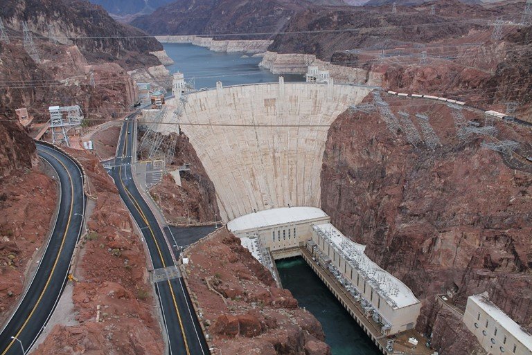
During the process of constructing a dam, various tools are involved. All the involved tools are geared towards ensuring the dam is located in a suitable location and can satisfy its users. Remote sensing techniques can be employed during the construction of a dam. Tools used in remote sensing techniques are airborne, and thus they can be used to survey the dam easily.
There is numerous application remote sensing technique in this field. Some of these applications are;
1. Selection of Dam Site
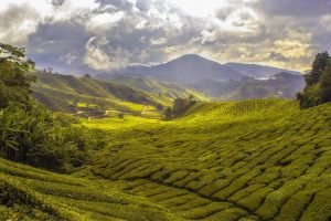
Various factors are considered when selecting a place to set up a dam. To get to these factors, various methods and techniques are also involved. One of the modern techniques used is the remote sensing technique. In this technique, the satellite images are analyzed, and the end information is used to decide the best location to set up a dam.
2. Detecting unknown dams
Dams exist in two forms, either natural or man-made dams. Natural dams are those that naturally exist along rivers or streams. Since they are natural, many people may not know if they exist. Thankfully, with remote sensing techniques, these dams can be noticed. After analyzing water bodies like dams, the remote sensors’ data are clearly shown.
3. Protecting dam sites
Many people rely on dam water as their main water source, and therefore they need to be protected. Remote sensors provide a cheaper and more reliable source of security. The remote sensors can send the information from the dam site to the relevant headquarters. Also, these airborne tools promote 24-hour security around the dam. Therefore, these techniques can provide security around the dam site.
4. Floods control
Many dams suffer from the problem of flooding, and this leads to their destruction. Did you know that these issues can be avoided? Remote sensors can be used to curb and control the occurrence of floods. The data from this sensor can show the height of the water in the dam when analyzed. This information is vital in controlling the occurrence of floods.
5. Geographical Analysis
The dam is one of the components that make up the environment. Therefore during the Geographical analysis process, it is also included. An airborne tool is used to study the dam and its neighboring components. Remote sensor tools can examine and analyze the region around the dam.
6. Weather prediction
The climate and weather of the region around the dam affect it directly. Remote sensors can detect any changes in the weather. This information may be used to control the flooding of the dam.
7. Site inspection
During construction, remote sensors may be employed to monitor the construction progress. This minimizes the face-to-face inspection, and thus total construction cost is minimized.
8. Environmental Impact Assessment
Remote sensors play a vital role in assessing the impact of the dam on the environment. The remote sensor can generate spatial datasets that are used in the assessment process. Other firms then use the information.