
Mapping is a timeless science as well as an art that has been around since time immemorial. It has been used by several people to identify places and find directions to destinations especially by early travelers and explorers. Hundreds of years ago, early mappers once made the mistake of mapping California as an island off the west coast of North America. But as technology advances, digital maps are unlikely to make the same mistake. So, what are some of the differences between digital maps and paper maps?
Paper maps:
They can be bought physically on physical stores: Paper maps are printed on physical papers and can be available for purchase on physical stores on your way home.
Storage requires physical space: Storage of paper maps requires that you keep them in a dedicated place in your house or in your suitcase since it can be physically handled.
Paper maps can be accessed offline: Paper maps are printed on paper that can be stored anywhere and can therefore be accessed from anywhere. You do not need a computer or internet connection to access it.
Mostly uses symbols to represent features and routes: Paper maps mostly rely on symbols to represent features or routes that are physically seen on land. You therefore need to interpret the symbols when reading paper maps.
Cannot be updated easily: Paper maps are printed on paper and can therefore not be updated on the same paper. This means that you cannot make any changes on the map based on the changes in landforms.
It is static: Paper maps are static representations of features on land at the time when the representations were created. One cannot modify to see the previous version of the area.
Paper maps cannot represent all features at the same time: paper maps usually make a representation of one aspect of the land at a time, For instance, a map could represent the rivers only or the geographical area of a place.
Paper maps are limited to specific area based on the scale of the map: Paper maps are representations that are limited on a specific area of the land and not the entire geographical location.
It requires skills to interpret because of the symbolic representation of features: Paper maps do not show objects but use symbols instead. Which means special skills are required to interpret the symbols when reading the map.
Good at showing boundaries and for data analysis: Paper maps are ideal for showing boundaries of an area and for analysis of data.
It is important for use as data storage and for comparison of change in landforms: Since they are static, paper maps are ideal for use as data storage for reference purposes when showing changes in land forms.
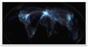
Digital maps:
They can be downloaded for free: Digital maps are not sold in physical shops but instead they are available online and can be downloaded for free.
Storage requires digital space: Digital maps do not require physical space for storage. They are stored in digital format and therefore require digital space.
Digital maps must be accessed online: Digital maps cannot be accessed anywhere else besides online. One therefore requires an internet connection to access them online.
Shows all features including time and the actual building: Digital maps do not depend on symbols to represent features. Instead, they show the actual features and the time.
Can be easily updated: Digital maps are mostly real time representations of an area and can therefore be updated easily because the changes will be updated automatically.
It is dynamic: Digital maps are dynamic which means one can choose to view the previous versions of the represented area unlike paper maps.
Digital maps can represent all features at the same time: Digital maps can be used to represent all features of a given area at the same time. They allow filtering for specific features but can also show the entire area.
Digital maps are not limited to any area: Digital maps are not limited to show only a specific area based on scale. They can be widened to show the entire area.
May not require special skills since it shows the real life object: Interpreting digital maps is easier than paper maps since the features are real representations of the real world objects.
Good at showing area overlays from various angles: Digital maps do not only show 2D representations of an area. They can be used to show the 3D angle of the area and also show the area overlays.
Cannot be used to show changes in land forms because it is always up to date: Digital maps are always up to date and may therefore not be ideal for use to show changes in land forms.

Meluan
29 Sep 2020This maps are so interesting because they saw many history
Jayson
23 Nov 2022I want the similarities and differences of digital maps and paper maps