GIS technology continues to play an important role in the study of the earth and all that is on the surface. Through GIS, geologists have been able to identify and figure out the puzzle that is the earth surface. We take a look at some of the importance of GIS in geology and how geologists have harnessed the power of this technology to identify solutions.
1.Mapping
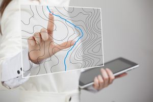
Mapping is a central function of Geographic Information System, which provides a visual interpretation of data. GIS store data in database and then represent it visually in a mapped format. People from different professions use maps to communicate. To create perfect maps, skills in cartography are vital. Google map, Bing map, Yahoo map are the best example for web based GIS mapping solution.
2. Urban Planning
GIS technology is used to analyze the urban growth and its direction of expansion, and to find suitable sites for further urban development. In order to identify the sites suitable for the urban growth, certain factors have to consider which is: land should have proper accessibility, land should be more or less flat, land should be vacant or having low usage value presently and it should have good supply of water.
3. Land Information System
GIS based land acquisition management system will provide complete information about the land. Land acquisition managements is being used for the past 3 or 4 years only. It would help in assessment, payments for private land with owner details, tracking of land allotments and possessions identification and timely resolution of land acquisition related issues.
4. Surveying
Surveying is the measurement of location of objects on the earth’s surfaces. Land survey is measuring the distance and angles between different points on the earth surface. An increasing number of national and governments and regional organizations are using GNSS measurements. GNSS is used for topographic surveys where a centimeter level accuracy is provided. These data can be incorporated in the GIS system. GIS tools can be used to estimate area and also, digital maps can prepared.
5. Detection of Coal Mine Fires
GIS technology is applied in the area of safe production of coal mine. Coal mine have developed an information management system, the administrators can monitor the safe production of coal mine and at the same time improve the abilities to make decisions. Fire happens frequently in coal mines. So it can assessed spontaneous combustion risk using GIS tools
6. Worldwide Earthquake Information System
One of the most frightening and destructive phenomena of nature is the occurrence of an earthquake. There is a need to have knowledge regarding the trends in earthquake occurrence worldwide. A GIS based user interface system for querying on earthquake catalogue will be of great help to the earthquake engineers and seismologists in understanding the behavior pattern of earthquake in spatial and temporal domain.
7. Geologic Mapping
GIS is an effective tool in geological mapping. It becomes easy for surveyors to create 3D maps of any area with precise and desired scaling. The results provide accurate measurements, which helps in several field where geological map is required. This is cost effective and offers more accurate data, there by easing the scaling process when studying geologic mapping.
8. Coastal Management
The coastal zone represents varied and highly productive ecosystem such as mangrove, coral reefs, see grasses and sand dunes. GIS could be generating data required for macro and micro level planning of coastal zone management. GIS could be used in creating baseline inventory of mapping and monitoring coastal resources, selecting sites for brackish water aquaculture, studying coastal land forms.
9. Land Use Changes
Mining is the back bone of the developing economy of any country. Mapping, monitoring and controlling the impact caused by the mining activities is necessary so as to understand the character and magnitude of these hazardous events in an area. The data required to understand the impact of mining from the environment is coming from different discipline, which need integration in order to arrive hazard map zonation.
10. Land Administration
In a number of countries, the separate functions of land administration are being drawn together through the creation of digital cadastral databases, with these database they can reuse land for suitable needs ,digital taxation and even utilities are also easily handle using these database.


Charlotte Copp
1 Apr 2018Environmentalist, Bruno Latour, says, “The goal isn’t to stop creating, innovating, or inventing, but to use our patience and commitment to the technologies we build.” This has inspired me to create a project that gets everyone involved! Are you interested in remote sensing or satellite data? if so, please participate in this environmental engagement project. Post a photo of a place you love and compare it to a satellite data layer. It’s interesting, fun, and a creative way to get people to interact, so try it out!
https://ds.lclark.edu/copp/stories-through-the-birds-eye/
hussenaden
24 Jul 2018the about gis & remote sensing r
elated geology send my email address.
Makori
28 Mar 2021Very nice
Thank you very much
Abdul Bari Zia
23 Sep 2021Thanks for the information.