
Remote sensing is the science of obtaining information about the earth’s surface using high-flying satellites and aircraft. Information obtained from remote sensing provides decision-makers with valuable and extensive data for mapping, environmental monitoring, and disaster management. Remote sensing has a wide range of applications in managing the environment.
1. Analysis and Management of Agriculture and Forests
Remote sensors and GIS applications are powerful tools for monitoring forested areas in the environment. Physical monitoring of forests is challenging due to the possibility of wild animals and many thick bushes in most forests. The remote sensing technique is an alternative method of monitoring these environments. Researchers place high-flying satellites and crafts above the target areas to observe any environmental changes.
2. Management of Water Resources
Water resource management entails planning, developing, and managing the optimum use of water resources. The government and other policymakers have put up various measures to protect water bodies internationally. Nonetheless, citizens fail to observe these measures and rules because there is no on-site monitoring and observations. Thankfully, remote sensors can now be used to monitor activities around water bodies.
3. Management of Air and Water Quality
Water and air are the most fundamental things in the environment; what could be an environment without these two? The safety of both water and air needs to be maintained at all times. The remote sensing technique manages air and water quality in the environment by detecting the causes of their pollution and providing information about their quality maintenance to the public.
4. Management of Infrastructure
Public and private physical structures such as roads, bridges, railways, electric systems, and water are components of the environment that need to be monitored frequently. It may not be easy for police officers to patrol all over; the remote sensing technique was introduced to solve such challenges. Satellite sensors are used to record and take images of all the activities near the infrastructures. Data from the sensors is analyzed, monitored, and used to plan better managing infrastructure.
5. Management of Natural Resources
Natural resources such as oil, coal, water, forests, and natural gas are valuable; hence can be easily tampered with through theft and misuse. Remote sensing techniques are used to protect these resources by recording all the activities in the environment. Sensors greatly reduce the abuse and theft of natural resources in environmental management.
6. Management of Natural Disasters
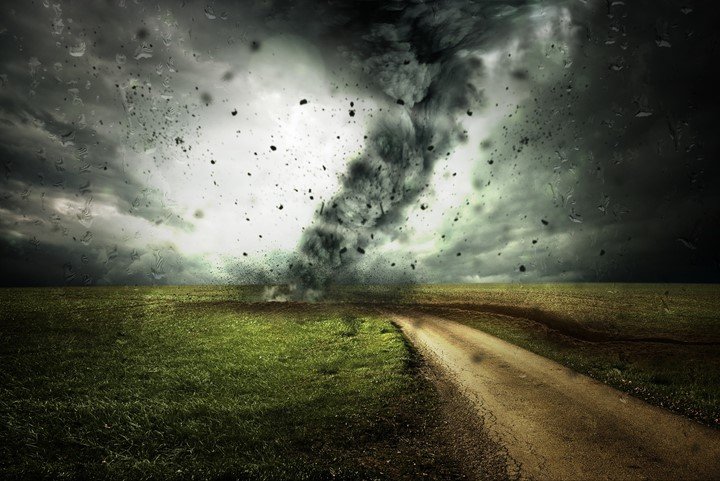
Natural hazards like floods and drought events are a great threat to the environment. They need to be curbed and controlled before and after their occurrence. Remote sensing tools come in handy in controlling fires, drought events, desertification, and floods. For instance, if there is a fire outbreak, satellite sensors allow rangers to observe the affected area effortlessly and to control the fire from spreading.
7. Weather Prediction
Remote sensors have proved to be perfect for weather forecasting and general predictions. The sensors’ information about weather is used to prepare the public for upcoming weather changes. Furthermore, sensors can also track erupting volcanoes which may help people relocate before the incident.
8. Analysis of Land Covers and Land Mapping
For proper environmental management, it is necessary to monitor the changes in land use and land cover patterns. Remote sensors are used to take images on the earth’s surface for land updates and road maps. Land mapping is important since it equips planners and administrators with the relevant information needed to develop that particular area.
9. Ocean Monitoring
The innovation of remote sensors has promoted Oceanography (study of the ocean). There is increased study, management, and discovery of more information about oceans, their waters, and their floor. With sensors, researchers can take images of deep oceans without swimming or traveling underwater.
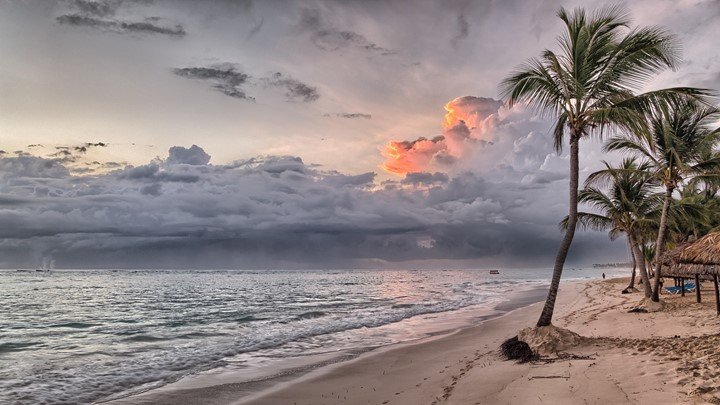
10. Coastal Monitoring
Coastal monitoring involves collecting data about the coastal environment. Remote sensors are used to monitor shoreline changes and measure oceans’ temperatures in the coastal environment. On the other hand, Geographic Information Systems help carry out developments, planning processes, and effective management of the coastal zone.
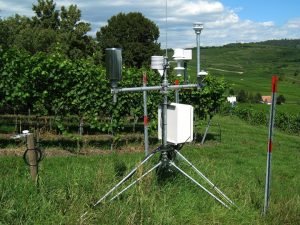
11. Soil Moisture Data
The topsoil layer is vital for agriculture and environmental growth; the soil is also important in forecasting weather and natural disasters for ecological management. A significant area of research currently taking place in the remote sensing field is the measure of soil moisture which entails measuring the top 5 cm of the earth surface. NASA’s soil moisture Active Passive (SMAP) Mission uses satellites to retrieve data about soil moisture after 2 to 3 days.
12. Vegetation Monitoring

The most appropriate index that analysts use in vegetation monitoring is the NDVI (Normalized Difference Vegetation Index). Remote sensors use NDVI to measure the difference between Near-Infrared and red light reflected and absorbed by plants. Data from the observations is used in agriculture, farming, and forest management.
13. Urban Planning
Urban planning involves designing, financing, and implementing strategies that affect the social impacts of the urban environment. Proper planning is needed to avoid congested environments in urban centers. In urban planning, the remote sensing technique chips in to take images of the total area covered by the urban. Images from the sensors are useful in the planning process.
14. Environmental Study and Habitat Conservation
Remote sensing is useful in detecting the cause of deforestation, volcanoes, pollutions, floods, and other natural hazards. Important information from these studies is put into practice to prevent more dangers in the future. Sensors are also useful in recording all the activities in a given area to maintain the safety of habitats.
15. Researching Tool
Remote sensors are used as research tools during research in environmental science. Researchers prefer sensors because they capture maximum data and cover a wider area than other research tools. Moreover, remote sensing technology is a great source of information for any studies or researches related to environmental management. Sensors have proved to be powerful tools used in environmental analysis and management.
The availability of remotely-sensed data from different sensors has made remote sensing the best data source for large-scale applications, research, and environmental studies. The technique has emerged as an effective tool for carrying out surveys, analysis, environmental planning, and the management of natural disasters globally.

Dmitrii
18 Jul 2022Thank you for the informative article. I would like to add to your 15 points such as remote sensing grazing management. At a minimum, it allows you to control the level of vegetation in the pasture, its size, what crops are grown, etc. You can also see critical areas, weather forecasts, and plan pasture management. I hope this additional information will be helpful to your readers. I got the information from https://eos.com/blog/pasture-management/