Landsat Data: One of the most popular free satellite data is Landsat data. By the effort from NASA and USGS, Landsat 1 was lunched 45 years back (1972) and the latest Landsat satellite is Landsat 8. Landsat 9 will be launched on 2020 (expected). There are different places on the web to download the data.
USGS Explorer: USGS website has Earth Explorer online web mapping to download the different years captured Landsat data. In three different way you can download the Landsat data of your area of interest.
Download Process:
You can search by address or Path/Row or your GIS data that set area of interest.
Once you set your area of interest then assign the image captured date range, then click on Datasets button.
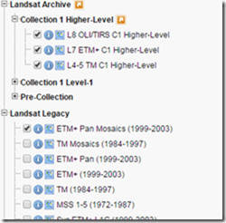
Select the proper type of satellite to get the results from the Landsat Archive or Landsat Legacy.
On the additional criteria you can filter out extra images, such as you can set the clouds cover percentage and more. You have to sign up for an account to download the data which is the last step.
Other places from where you can download Landsat data:
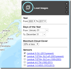
1.1 LandsatLook Viewer is other web mapping, where you assign the image captured date, type of satellite, Cloud Cover. Show images will display number images according to the search criteria.
1.2 Open the metadata to download the data. You have to Signup to download the Landsat dat.
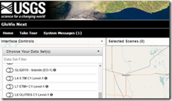
2.1 Glovis next, you can search the data by zoom in to your area of interest. Old version requires java to install, so you can use Glovis next which is web mapping platform.
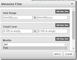
2.2 Under Metadata filter you can assign image captured date, cloud cover (0 to 100) and Month.
You have to Log In to download the data.
Sentinel 1 & 2 Data: European Space Agency provides free access to satellite image captured by Sentinel 1 and Sentinel 2 satellite. Both the satellite were lunched between 2014 and 2015. Sentinel provides high and medium resolution (5m to 20m) of the land and ocean surface data. The image is continuous of day, night or all-weather.
Sentinel 2 consists of two satellites which provides image used to see land surface example flooding, forestation, natural disaster and many more. It has 12 bands with 10 to 30 m image resolution.
Download Process:
First register for an account and activate it by clicking the link send in your email.
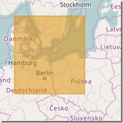 Then drag the area of interest by holding the right mouse button which will look as in image on left.
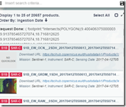
After that press Search button which will be the input for the area of interest, then click search button again to display all the images available. Click the download link, images are in zip format.
Reverb ECHO: 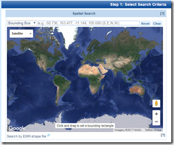 NASA run data deport where you can find thousands of kinds of images: Aura, Terra, TRMM, Calipso, NASA DC, JASON, ENVISAT, METEOSAT, ALOS, GOES, ICESAT, GMS, NIMBUS, Landsat, SMAP, NOAA satellites, RADARSAT, GPS satellites and many more. There are different way to search the data, you can spatial search or by using terms. Displayed search result you can view the metadata before download the data. Metadata will provide you information about the data. This page have tons of information about how to search and download the data, including YouTube videos.
National Institute for Space Research (INPE): Brazilian and Chinese government has a partnership to create a central satellite image data depot for Brazil and Africa area. You can download their own satellite data: Satellite 2 and 2b (CBERS-2, CBERS-2b) and also most popular world free data: Aqua, CBERS, Landsat, ResourceSat, S-NPP, Terra & UK-DMC 2.
Download Process:
You have to Singup to download the data, read the instruction on their image catalog. Instructions are in Portuguese which can be translated into English. Filling the information on the instruction page will take you to the download page.
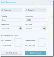
Basic parameters are simple and same as most of the image downloading web mapping. On the basic parameters you will assign the type of satellite, image date captured and cloud cover percentage. Click the Search Images button to display the image list, add to cart which will take you to download page. You are required to Signup or existing username to download the data.
Bhuvana Indian Geo-Platform of ISRO: Indian government has done tremendous advancement in the field of the space technology. ISRO was established in 1962, headquartered in city of Bangalore. It provides all its satellite image through the Bhuvana Indian Geo-Platform of ISRO.
Download Process:
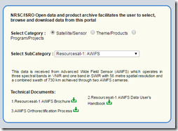
You select the Category and then Subcategory.
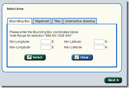
Then assign the area of interest, you have four option to assign the area of interest. Then press Next
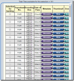
Download link will be available with additional information about the image. You are required to have an account to download the data.
Conclusion: Please comment if you know any sources for free satellite Data.







gebi
27 Sep 2018I need to be member of this technology.