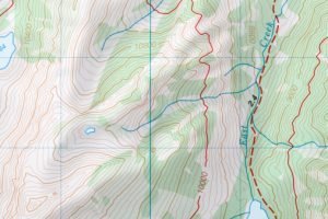
Cadastral Maps are the type of maps that contains cadastre data. The cadastral data is usually the information on the part of the earth. Therefore, these maps are useful in cadastral management. In the cadastral survey, GIS and other airborne components are primarily used to collect the cadastral data. Due to their ability to capture spatial information, cadastral maps help provide comprehensive, precise, and accurate information. Below are some of the typical applications of cadastral maps.
1. Apportioning Taxes
Apportioning taxes is the method of assigning taxes to individuals and companies. Various analytical tools and methods are employed to arrive at a fixed tax. The government uses cadastral maps to track and evaluate the number of properties owned by an individual. These maps conserve the time and effort of tax agencies.
2. Establishing Land Ownership
Establishing the land boundaries has been a stumbling block. Thankfully, Cadastral maps can fix this defect. During the creation of cadastral maps, airborne component record the earth’s details from space. The collected spatial data clearly shows the land boundaries.
3. Vegetation Management
The satellite images in the cadastral maps are essential in motoring land cover changes. Agriculturalists rely on this tool, cadastral map, in the analysis tasks. The spatial data in these maps show the distribution of vegetation in a selected area.

4. Cartographic records
Cartographers extensively use cadastral maps. During the mapmaking process, cartographers use cadastral data as the raw material. In addition, some of the cartographic records are kept in cadastral format.
5. Atlas Making
Atlases are booklets that contain geographical information. A Cadastral map is a critical spatial data source in the atlas-making process. Besides that, in cartography, cadastral maps are helpful in mapmaking.
6. Maintaining Land records
The process of documenting a given land employs numerous components. Cadastral maps, for example, has a huge role in determining the nature and terrain of the land in interest. Therefore, these maps provide helpful information that can be used to analyze a given land.
7. Positioning structures
Cadastral maps capture details of a selected. These details include buildings, industries, and schools, among other structures. Cadastral maps can helps in locating and positioning a given structure at ease.
8. Recreational Purposes
A cadastral map is an excellent exploring tool. Before traveling to unfamiliar places, you must have a Cadastral map. When using this type of map, one can easily locate the recreational areas in a given area. Similarly, one can approximate the distance between their live locations and the feature.
9. Building Planning
During the initial stages of construction, cadastral maps are used to survey the topography of the land in question and the condition of the soil. Then, digital maps are used during the construction phase to monitor the progress and guide the engineers. In addition, to determine the gradient of the land, civil engineers use these maps to check the elevation of two points in the area of interest.
10. Municipality property management
Cadastral maps help oversee municipality properties and utilities. Airborne components collect spatial data; therefore, a wide area is covered simultaneously. The spatial data collected can be analyzed and used to manage municipality utilities.


