Cartography is the art of graphically representing areas or locations on a map. It involves the scientific and artistic elements in combining the geographical locations and analyzing the positional relationships, which are essential in mapmaking. Cartography has several applications in various fields besides the mapmaking process. This article will examine the applications of cartography in Geography.
1. Collecting geographical data
The field of geography relies on various sources of raw materials. Since the old days, cartography has been the primary source of geographical data. Geographical researchers use the knowledge of cartography to collect and prepare the dataset used for educational purposes.
2. Mapmaking
In geography, maps are essential components. However, to make these maps, cartography knowledge must be employed. Cartography provides the information and data needed in the mapmaking process and the positional relationships. In addition, the cartography process oversees the graphical representations of areas on a flat surface.
3. Visual Representation of data
Cartography is a vital technique when creating visuals of a given data. Cartography knowledge is helpful in the conversion of geographical information to maps. In geography, the technique aids in making maps and positioning areas on a flat surface.
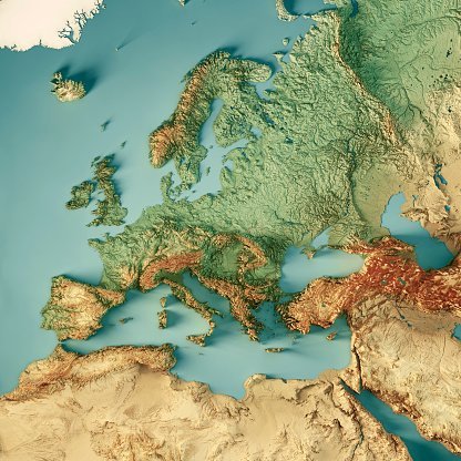
4. Representation of Geographical features
Geographical features such as mountains and hills are too big to fit on flat surfaces such as maps and other geographical documentaries. Thankfully, the technique of cartography got geographers covered. Using a mapping scale makes it easier to keep down the size of these geographical features, and thus they can easily fit on flat surfaces.
5. Analyzing Natural features
Maps are essential in analyzing and grouping natural features. Studying and analyzing natural features is a crucial area of study in geography. However, researching and analyzing these features without cartography knowledge would be challenging. Today, geographers can have a copy of natural components on flat surfaces like maps.

6. Updating existing maps
After the mapmaking process is over, the process of updating maps precedes. The cartography technique adds new features and details to the existing maps in this process. During the process-making process, some essential features may be omitted. To re-add these locations and areas, geographers employ the knowledge of cartography.
7. Estimating Distances
Field study, a branch of Geography, hugely employs the knowledge and technique of Cartography. When estimating the distance between two places, geographers can apply the map scaling technique to calculate the distance between two points.
8. To show Geographical concepts
Cartography is used in making thematic maps, which display the geographical concepts of a given area. This type of map is used to show the spatial relationships and varying geographical concepts between areas.
9. Publications of Geographical articles
Most of the geographical articles and documents extensively use the knowledge of cartography. Here, this knowledge is used to generate maps in these documents and resize the geographical features. In addition, this technique has a gist application in determining the boundaries of the land on the map.