
QGIS has become a powerful mapping software and best thing is it is free. You can download it from QGIS official website. If you do not have a good skill on QGIS tools, then please read my earlier tutorial on QGIS Basics. Today I thought I should write tutorial on adding X and Y coordinates from the excel file. If you like to read about adding X and Y coordinates on the ArcGIS then I have written 5 ArcGIS Tips helps you to perform you daily job.
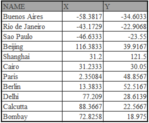
Well if you do not have the QGIS software then download it from its homepage. I have few longitude and latitude value of world cities. Remember longitude is always X and latitude is always Y. If you want to practice on this data, then copy this and paste into excel sheet.
There are are two ways to add X and Y value from Excel into QGIS.
A. By converting Excel data into Delimited Text
1.In excel save the table into the Text (Tab delimited)

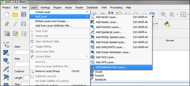
2.Open the QGIS software, for this example I am using QGIS 2.8.2 version. Now click the Layer > Add Layer > Add Delimited Text Layer.
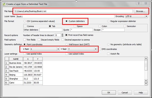
3.Browse the saved delimited text file (in our case is Book1.txt), then you can assign the layer name. Select the Custom delimiters which will automatically check mark the Tab option. In table if you already have X and Y field names then it will automatically assigned into appropriate filed, if you have something different then assign your field names in x field and y field. Other option leave as it is, after that press Ok.
4.Then select the appropriate projection system of your x and y values, for above table the coordinate system is WGS84. Then press Ok to finish the process.

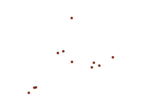
5.After that you will notice points are plotted on the main window.

B. By using XYTools Plugin
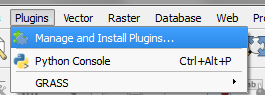
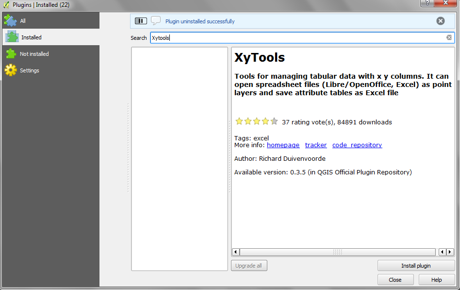
1.Download the plugins by going to Plugins>Manage and Install Plugins
2.Under the search box type Xytools and press Install Plugins. This will install Xytools plugin and you will have many option to play with x and y coordinates including adding x and y values directly from excel sheet.
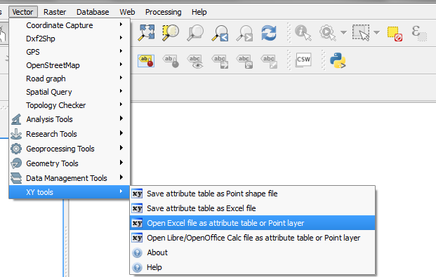
3.Under Now go to Vector>XY tools>Open Excel File as attribute table or point layer, this will open the browse window.
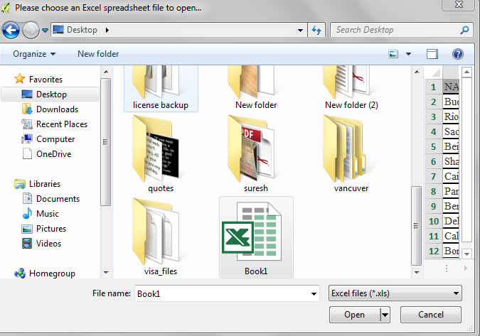
4.Browse your excel file, best practice to avoid version conflict save excel file in 2003 format and press open.
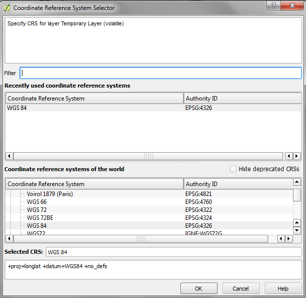
5.Now select the Coordinate Reference system, for our example is WGS84 and then press OK.
6.Then assign your X and Y field under X: and Y: drop box.

7.Points will be plotted on the main window.

Shanmugavel S
29 Nov 2017there is a add delimeted layer option in qgis, when using it you could get this result then how it differs from using the plugin
admin
29 Nov 2017Thanks for the question: