Remote sensing is widely used in coastal engineering in estimating sea surface temperature, chlorophyll content, suspended sediment concentration, yellow substance concentration, wave characteristics, and potential fishing zones. Oceanography is important seeing that the ocean is affected by pollution, weather change, marine life extinction, and coastline eruption. As a result, there is a need for tools. A variety of satellite remote sensing data has provided information used in managing coastal resources. The following explains the application of remote sensing in oceanography:
1. Estimating sea surface temperature
In estimating sea surface temperature, several remote sensing techniques are applied. An essential requirement for remote sensing is detecting electromagnetic radiation (EMR). Satellite TIR sensors receive EMR quantified to measure the top of atmospheric radiances. It entails upwelling radiances emitted from the ground and upwelling radiances from the atmosphere. Also, the downwelling radiance is released from the atmosphere and reflected from the earth.
2. Potential Fishing zones
Remote sensing saves time when locating fishery resources along the coastal regions. Satellite remote sensing is useful in locating potential fishing zones (PFZs) as it provides comprehensive views of the ocean and can detect mesoscale through visible and thermal infrared sensors. Various features that include eddies, rings, Oceanic fronts, meandering patterns, and upwelling areas from satellite images are transferred to nautical charts and used as potential fishing zones advisories. Satellite remote sensing techniques are used to detect fish aggregation. The techniques are used to predict potential fishing zones by measuring parameters that affect fish distribution.
3. Waves characteristics
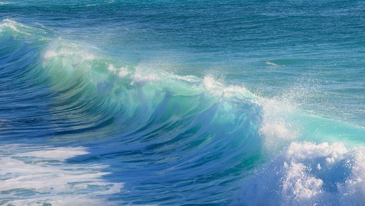
Small water surface waves are essential in designing marine structures such as breakwaters, ports, harbors, seawalls, jetties, and canals and designing ships. Remote sensing images of the coast and ocean show effects of water faucet reflectance. The random wind waves impact natural shorelines, oil and gas platforms, and wind turbine farms in the coastal area. When increasing the scientific understanding of water waves on satellite imagery, three channels multispectral imaging system and hyperspectral imaging using space-time imaging techniques are used.
4. Suspended sediment concentration
Suspended sediments are important in water quality management as they are related to total primary production and fluxes of heavy metals and micropollutants such as PCBS. Waves that come from the deeper section of the ocean provide a driving force to lift sediments from the seabed and move them around. Measurement of the concentration includes spatial, either satellite, or airborne radiances integrated over wavelength ranges according to the sensor channel sensitivities. Atmospheric corrections enable one to calculate sea surface radiances from the extra atmospheric data. Visible satellite data is used to estimate the water contents in T and with more refined algorithms in three types of constituents, namely phytoplankton pigments, dissolved organic matter, and sediments.
5. Chlorophyll content
Chlorophyll is the pigmentation found in plants. In the ocean, it is used in phytoplankton. Phytoplankton in the ocean causes selective absorption of light by the chlorophyll pigment that, in turn, causes a change of the ocean color that can be identified by ocean color remote sensing.