Image classification is the process of identifying and categorizing images according to their appearances or pixels. Image classification is paramount as it enables collected images to be grouped into one class/group, which eases the process of analyzing them. In the current world, remote sensing technique has played a major part in taking images and analyzing them. The analyzed images are then used in the classification process.
Let us now discuss some of the common remote sensing applications in image classification.
1. Digital Image analysis
Image classification is an important field in digital image analysis. It creates a base from which images are analyzed. Remotely sensed images come in different colors and pixels. These diverse colors are used to analyze the study area and draw conclusions. Similarly, the collected images are used to update inventories of digital images analysis.
2. Statistical analysis and classification
The use of image classification achieves statistical analysis and classification. Space images are used to provide information used in the statistical field. For example, the distribution of population and land covers can be examined by remote sensors. The sensed data is the raw information for statistical analysis and classification purposes.
3. Categorizing Different classes of land covers
There are existing different land cover classes. A modern and powerful tool is needed to analyze and group these land covers into groups. Remote sensing techniques combine both the data collecting and image classification tools. Therefore, it fits best in this field. Firstly, remote sensors take space images of the land covers. These images are then analyzed through image classification, and diverse land covers are derived from the sensed images.
4. Government and private applications
Image classification is a modern technique employed in both the public and private sectors. Government can use this tool as evidence when appealing for support. In such cases, remote sensors take images of the region or country in question. The collected images can then be analyzed using the process of image classification and later be used as the basis of a contract between the government and the sponsor. In the private sector, remotely sensed images are used to monitor the property.
5. Unsupervised image classification
Unsupervised image classification is a sub-class of image classification that examines large pixels and groups them. Remote sensors tools can determine the spectral class of the collected images, which is used to classify unsupervised images.
6. Image processing packages
Images processing involves converting raw images into useful information. This process employs image classification and remote sensing tools. Image classification is vital here as it groups images in their classes. On the other side, remote sensors are used in the field to collect data since they capture a wide range of views at once.
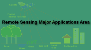
7. Production of thematic maps
Thematic maps show the distribution of the land covers in image form. Remote sensors collect these image images since they are airborne tools. Then, the sensed images are used to produce thematic images.